
Lockheed Martin is preparing a series of demonstration flights to prove the capability of its K-Max unmanned air vehicle to transport and deploy an autonomous ground vehicle. In an effort to prove the potential of “robots moving robots”, the VTOL UAV – derived from the manned Kaman helicopter – will next month take part in the US Army-led trials which will see it carry a Lockheed Martin Squad Mission Support System (SMSS) at Fort Benning, Georgia. Continue reading
Category Archives: VTOL
DJI DropSafe Emergency Parachute System
DJI DropSafe is an parachute system for DJI multirotors s that launches a parachute in the event of a power failure. DJI calls it a “drop speed reduction system,” and does not guarantee that it will protect equipment or prevent injury. Continue reading
ING Robotic Aviation and ASG Mapping use Robotic Aircraft for Advanced Agricultural Data Gathering
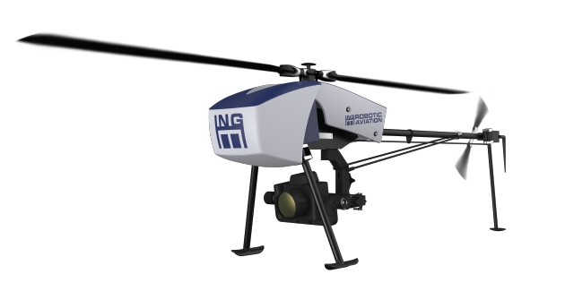 ING Robotic Aviation is partnering with ASG Mapping to rigorously assess and develop the application of small robotic aircraft systems for gathering high quality, positionally accurate, and interoperable geospatial data.
New Zealand Hires DJI Phantom to Take ‘Dronies’ on Ski Slopes

New Zealand’s tourism authority is now planning to cash in on the trend, buying a $1400 DJI Phantom 2 Vision+ drone to tour the country’s ski slopes, as well as Queenstown and Lake Tekapo, to capture tourist dronies.
CybAero Announces New Engine Supplier
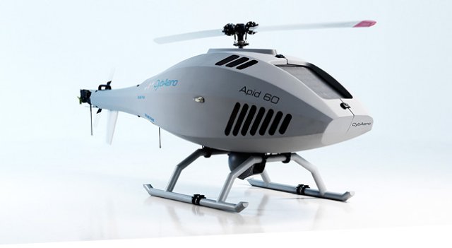 First North-listed CybAero, which develops and markets unmanned helicopters, announced at a press conference at the Farnborough Airshow in the UK that it is switching to a new engine and engine supplier for its Apid 60 aircraft.
Bulgaria Wants All-Weather Reconnaissance UAS
The U.S. Army has issued a market survey for a 10-pound UAS with hover and stare capability that would be suitable for the Bulgarian armed forces. Officials of the Army Contracting Command at Aberdeen Proving Ground, Md., issued a sources-sought notice to locate potential sources to deliver and train vertical take-off and landing (VTOL) UAV systems for foreign military sales to Bulgaria. Continue reading
UAV Mapping of a Landslide

At the end of May 2014, UPVISION, a Czech unmanned aerial vehicle and mapping company, conducted a UAV survey of a landslide on Highway D8, currently under construction near the city of Litomerice, in the northern part of the Czech Republic. A geological survey was conducted on Highway D8, which had been under construction at the time of the landslide. Continue reading
InvertiX 400 Quadrotor Can Flip and Fly Upside Down
The InvertiX 400 quadrotor, designed by Bobby Watts, can be flipped over quickly while in flight, and continue manoeuvres while while flying upside down, enabling the operator to engage in some unique aerobatics. Continue reading