
Biorobotics researchers at a University in France have created a drone by taking inspiration from one of the Earth’s smallest winged creatures. Continue reading
Teenage Serial Drone Flier Arrested in Tokyo

A mischief-making teenager has been arrested by police after posting an online video threatening to fly his drone at the jam-packed Sanja Matsuri festival in Tokyo’s Asakusa district. Continue reading
US Air Force Moves to Bring About RPA Mission Relief
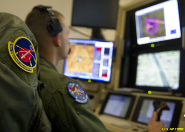
The US Air Force is pursuing a range of options that will, in combination with a reset in the number of sustainable combat air patrols, help alleviate long-term stress on Remotely Piloted Aircraft crews. Continue reading
Robonic and Lockheed Martin Team on New‐Generation Tactical Drone Launcher
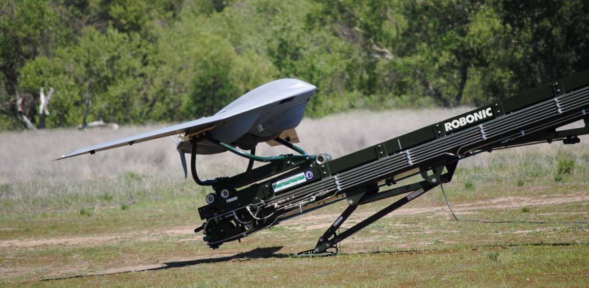 Robonic Ltd Oy of Finland (Sagem / Safran) and Lockheed Martin of the United States have signed an agreement to develop a smaller, more efficient and transportable fourth‐generation pneumatic launcher for drones, called OHTO.
Unmanned Aircraft Used to Survey Ice for Whalers
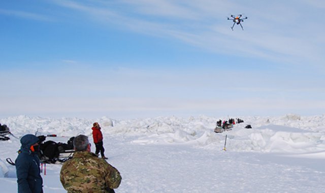
Researchers used an unmanned aircraft to map the sea ice north of Barrow in April as part of a cooperative effort between the Native community of Barrow and the University of Alaska Fairbanks. Continue reading
IAI Adds 3D to Training Simulators
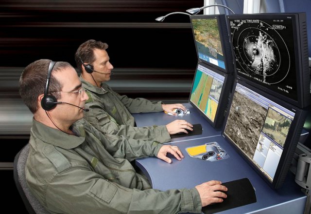 Israel Aerospace Industries has acquired a full independent capability for UAS payload simulation by purchasing TView, a 3D image generator for simulation and C4I applications from Tiltan Systems Engineering, an Israeli company.
US Navy Needs Help to Defeat UAS Cyber Threats
 The US Navy says it’s not sure what kind of cyber threats its drones, sensors and missiles are up against. That’s because aerial weapons systems were not expected to become part of the so-called Internet of Things, the present-day entanglement of networked appliances, transportation systems and other data-infused objects.
Curtiss P-40B Pearl Harbor Survivor
This Curtiss P-40B is unique as she is the only remaining airworthy survivor from the Japanese attack on Pearl Harbour on 7th December 1941. In additional to this auspicious history she is also the oldest airworthy P-40B in the world. Continue reading