
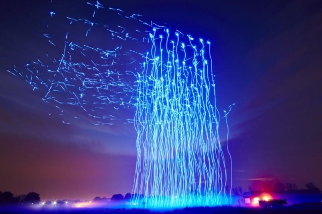
 Drones 100, Intel’s world-record-holding drone performance, will be making its public debut as part of Vivid Sydney. For five nights only, from 8 to 12 June, 100 illuminated drones will perform a spectacular choreographed routine over Sydney Harbour, accompanied by the breathtaking sounds of the Sydney Youth Orchestra.
Category Archives: Technology
Airbus Unveils Thor – Fully 3D Printed Test UAV
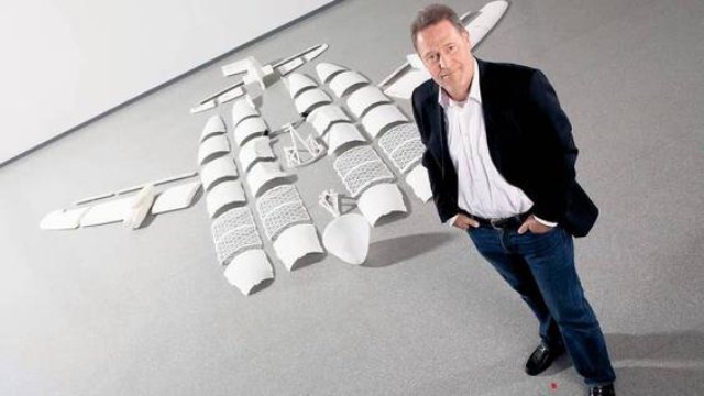 When it comes to nurturing and promoting advancements in 3D printing technology, very few companies have taken the initiative that the European airline manufacturer Airbus has. The aerospace manufacturer started fully immersing itself into the world of additive manufacturing back around 2014, when they equipped their A350 airliner with a titanium 3D printed cabin bracket, and also utilized the first 3D printed spare part on an aircraft being used by Air Transnat. Continue reading
 World’s First Electric VTOL Personal Flight Vehicle
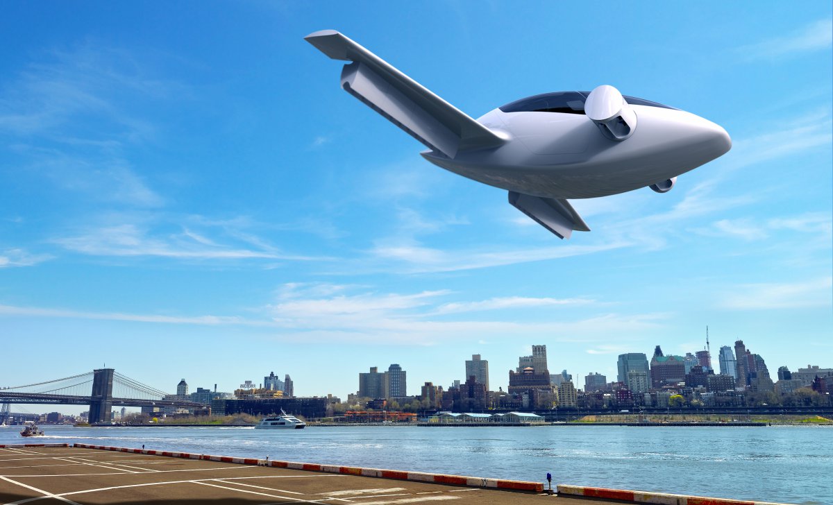 The European Space Agency (ESA) is backing a German startup working to develop the world’s first vertical take-off and landing (VTOL) personal flight jet aircraft for consumers.
Using Wi-Fi To See Through Walls
Yasamin Mostofi, associate professor in the Department of Electrical and Computer Engineering at UCSB, has designed a new technology that uses simple WiFi signals to allow unmanned vehicles to essentially “see” through walls. Continue reading
DARPA Demo Day at the Pentagon
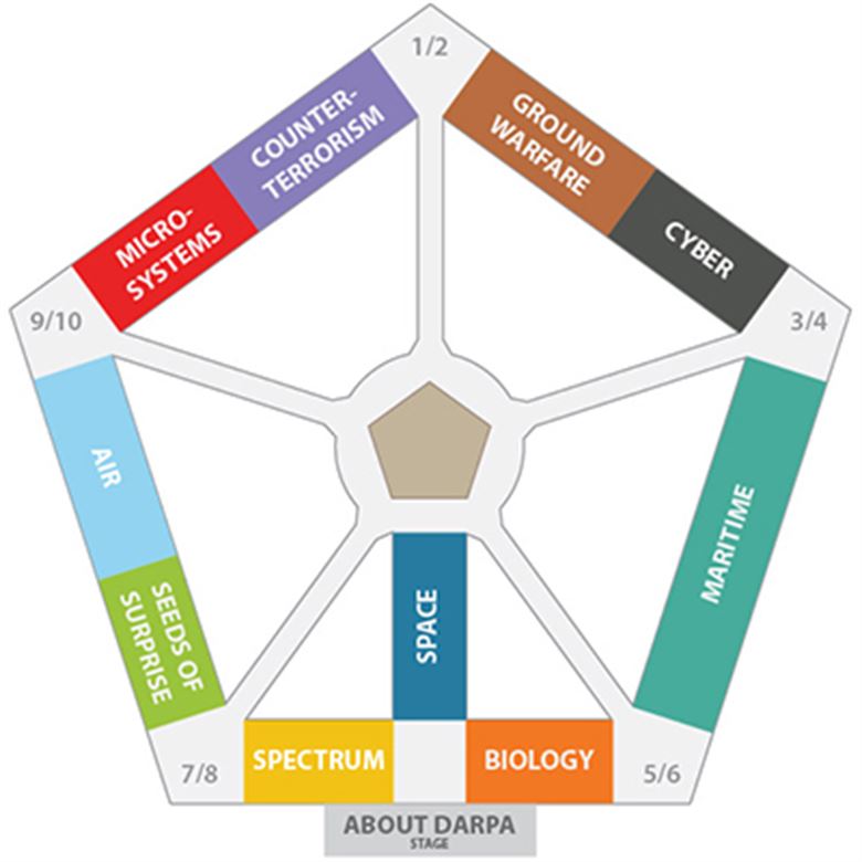
The Defense Advanced Research Projects Agency yesterday hosted DARPA Demo Day 2016 at the Pentagon, giving the Defense Department community an up-close look at the agency’s portfolio of innovative technologies and military systems. Continue reading
Bomb-Sniffing Drone Technology
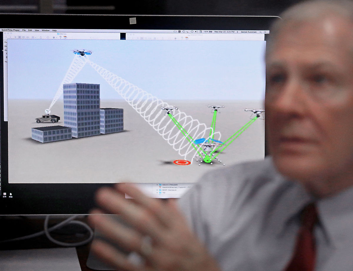
An animation of drone technology used to detect explosives is shown on a computer screen in the office of Jerry Kulcinski, emeritus professor of nuclear engineering and director of the Fusion Technology Lab.
Drones may soon have the capability to save thousands of lives each year by detecting terrorists’ improvised explosive devices and active land mines from long-ago wars thanks to innovative technology developed at UW-Madison. Continue reading
Award for Drone Noise Reduction Technology
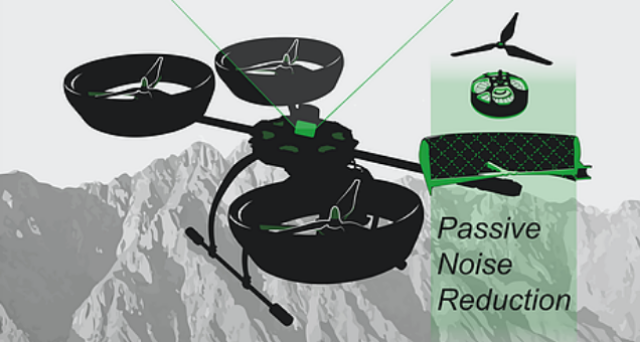 New Zealand startup Dotterel Technologies has won an innovation award for its noise-reducing drone technology at the 2016 NAB Show, the world’s largest annual convention to launch innovative products to key influencers in media, entertainment and technology. Continue reading
DARPA XS-1 Program Enters Phase 2
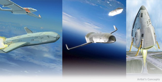 In an era of declining budgets and adversaries’ evolving capabilities, quick, affordable and routine access to space is increasingly critical for both national and economic security. Current satellite launch systems, however, require scheduling years in advance for an extremely limited inventory of available slots. Moreover, launches often cost hundreds of millions of dollars each, due in large part to the massive amounts of dedicated infrastructure and large number of personnel required. DARPA created its Experimental Spaceplane (XS-1) program to help overcome these challenges and create a new paradigm for more routine, responsive and affordable space operations, reducing the time to get capabilities to space.