
In China’s Hebei province, environmental authorities have dispatched unmanned aircraft to look for the sources of air pollution, and monitor the daily emission of factories. They flew to industrial zones in the cities of Tangshan and Xingtai. Continue reading
Category Archives: Non-Military & Commercial UAS
Meteorologist Develops Cloud Seeding UAS in Nevada
Meteorologist Jeff Tilley is developing a UAS that could help produce billions of gallons of additional water each month through a process called cloud seeding. Tilley’s current cloud seed generator shoots tiny silver iodide particles into storm clouds to help transform water vapor into snow or rain. The conversion takes about an hour. Continue reading
Australia’s Maptek Invests in Australia’s TopoDrone
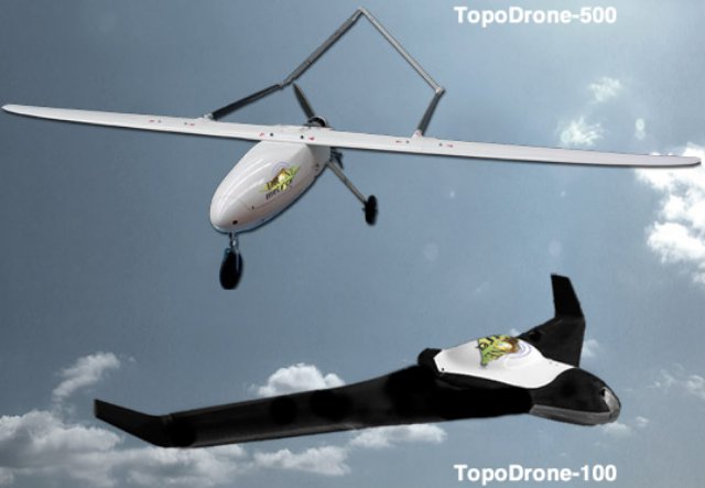 Mining computer tech company Maptek has made a significant investment in an Adelaide-based start-up, DroneMetrex . Dronemetrex has developed an innovative new system for aerial photogrammetric mapping from a small unmanned aircraft system (UAS) called the Topodrone-100. Continue reading
UAS Plus Algorithms Stop Poaching in Africa
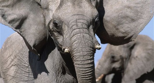 This week, a major summit began in London aimed at tacking the $19 billion a year trade in illegal wildlife trade, which is causing the populations of some of the most charismatic and endangered species on Earth to crash to critical levels. Last year, 1,004 rhinos were killed in South Africa alone, and more than 25,000 elephants were killed by poachers across Africa. That is three elephants every hour, every day. If there is one thing that every participant at the summit can agree on, it is that the current approach is not working. Continue reading
Singapore’s ST Aerospace Displays CM100 Gimbal from UAV Vision of Australia on its USTAR-Y UAS
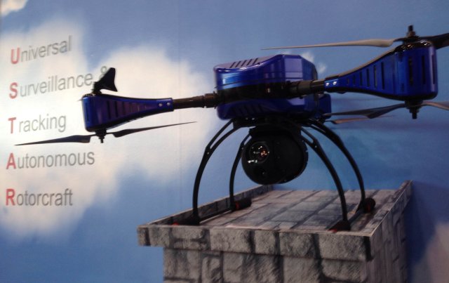
Presented at the Singapore Air Show 2 weeks ago, the USTAR-Y from ST Aerospace is a portable hexa-rotor UAS, specially designed for urban and open terrain applications. The VTOL concept provides adaptability and manoeuvrability, and also has a tool-less assembly which allows for a quick system set-up, thus reducing turnaround time. Continue reading
Sweden’s Hexagon Acquires Germany’s Aibotix
Swedish measurement and design group Hexagon has acquired the German UAS manufacturer Aibotix. The acquisition was made in order to complement the Life of Mine solution put out by Leica Geosystems. The jewel in the Aibotix crown is the Aibot X6, a six-blade rotor system or ‘hexacopter’, representing a new generation of vertical take-off and landing UAS that will be used to implement aerial mine mapping through the Life of Mine software. Continue reading
UAS Help New Zealand Farmer Count Sheep and Assess Grass Quality
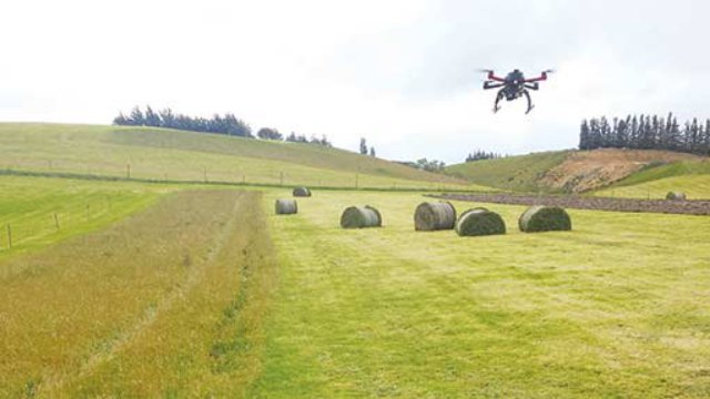 Three years ago, New Zealand farmer Neil Gardyne was watching a documentary about the war in Afghanistan and became inspired about new practical farming methods to farm his upland sheep, beef and arable farm in the Otama Valley, near Gore. “I was watching the documentary with my son Mark, and we were looking at how UAS were being operated for military purposes. It got us thinking how we could use such technology on our farm,” he says.
Netflix “Drone2Home” Delivery Service
Netflix has issued a late response to the Amazon spoof about delivery by UAS. Continue reading