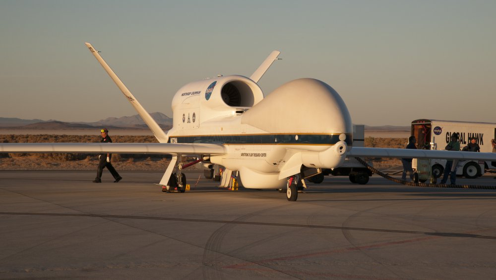
Designed by Createk Design Lab at the Université de Sherbrooke in Quebec,the Multimodal Autonomous Drone (S-MAD) can repeatedly perform autonomous landing and takeoffs from walls. Presented at Living Machines 2017, Stanford (Best Robotics Paper Award). Continue reading
Category Archives: Non-Military & Commercial UAS
Tracking Pythons in Everglades with Thermal Technology
Volaero UAV & Drones Holdings Corp., a Miami based Drone Tech Startup Company, has teamed up with Bill Booth Outdoors and Bruni Infrared to utilize its advanced drone imagery technologies to create solutions for the python issues in the Florida Everglades. Continue reading
Farmers Insurance Gets Drone Fleet

Farmers Insurance has announced that it has enlisted a fleet of unmanned aerial aircraft systems (UAS) to enhance the claims experience for customers who have suffered significant damage to their roof following major weather events. Continue reading
Drones to Protect Koala Bears in Queensland
Queensland University of Technology will deploy drones in a high-tech effort to find and protect koalas in South East Queensland, with the State Government announcing a funding boost for koala conservation. Continue reading
NOAA Picks SuperSwift for Nighttime Fire Observation
Black Swift Technologies (BST), a specialized engineering firm based in Boulder, Colo., is supplying its small unmanned aircraft system (sUAS) for the National Oceanic and Atmospheric Administration’s (NOAA) nighttime wildfire measurements. Continue reading
CSIRO and Ruralco Team to Push Digital Management and Drones on Farms in Australia
CSIRO and agribusiness, Ruralco, have teamed up in a partnership which will promote greater use of digital technology, including drones and long-range sensing in agriculture. Continue reading
UK Small RPAS Mid-Air Collision Study Published
The Department for Transport, the Military Aviation Authority and British Airline Pilots’ Association commissioned a study into the effects of a mid-air collision between small remotely piloted aircraft systems (RPAS, commonly known as a drones) and manned aircraft. Continue reading
Precision Farming via Satellite Imaging
Precision farming is set to become even more precise with a new camera drawing on satellite imaging. Thanks to research with ESA on new cameras, hyper-spectral cameras flying on drones are now able to see details as small as 4–5 cm. Continue reading


