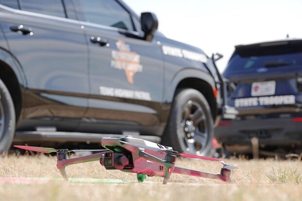
Skyfire Consulting, a public safety UAS consulting group, has announced the launch of Rise DFR Village— an advanced training ground for Drone First Responders (DFR). This one-of-a-kind facility provides public safety agencies, military/DOD, critical infrastructure, and private industry with best-in-class testing, training, and demonstration grounds to advance and adopt DFR programs. Continue reading
Category Archives: First Responders
Japan Tests Airlifting Defibrillators by Drone at Golf Course
Testing is underway in Japan to transport automated external defibrillators via drone at a golf course near here, hoping to quickly deliver assistance to golfers who suddenly fall ill. Continue reading
Advanced Noise Suppression Technology for Improved Search and Rescue Drones
Unmanned Aerial Vehicles are beneficial in search and rescue missions during natural disasters like earthquakes. However, current UAVs depend on visual information and cannot detect victims trapped under rubble. While some studies have used sound for detection, the noise from UAV propellers can drown out human sounds. Continue reading
TEKEVER Drone Successfully Demonstrates Lifeboat Deployment in Italian Coast Guard SAR Exercise
TEKEVER recently achieved a milestone in maritime safety through the successful deployment of a lifeboat from its AR5 drone. The groundbreaking technology was demonstrated during a search and rescue exercise conducted by the Italian Coast Guard in partnership with the European Maritime Safety Agency (EMSA). Continue reading
Dedrone Announces DedroneBeyond to Enable Scalable Drones as First Responder Operations
Dedrone has announced the launch of DedroneBeyond, its solution to enable drone operations to fly beyond visual line of sight (BVLOS) for state, local, territorial and tribal (SLTT) law enforcement and emergency services when deploying drone as first responders (DFR). Continue reading
Skydio Launches X10 AI Powered Autonomy Drone for First Responders and Military
Skydio has launched Skydio X10, a drone designed for first responders, infrastructure operators, and the US and allied militaries around the world. It has the sensors to capture every detail of the data that matters and the AI-powered autonomy to put those sensors wherever they are needed. Continue reading
New Drone Research Advances Wildfire Monitoring
Typically, the primary indicator of a burgeoning wildfire in California is a plume of hazy, gray smoke wafting through the air, seen by satellites or cameras. The California Department of Forestry and Fire Protection, or CalFire, is alerted, and mitigation and containment efforts ensue. Continue reading
IN-FLIGHT Data Authorized to Operate Drone Swarms BVLoS for Wildfire Emergency Management in Canada
Canada has authorized IN-FLIGHT Data to operate drone swarms beyond visual line of sight (BVLOS) for fighting wildfires in Canada. This national authorization allows for simultaneous drone operations up to 2,500 feet high, in Class F and Class G airspace, day or night. Continue reading