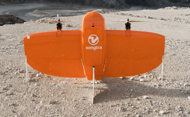
Category Archives: Geology

Dutch Drone Maps Seychelles National Park

The interior region of Silhouette Island, one of the Seychelles Islands in the Indian Ocean, is a national park, with some of the richest biodiversity in the entire Indian Ocean. It is also home to several, critically endangered, plants and animals. In order to keep track of the different species on the island and gain insights into the unique ecosystem, an up-to-date map is an essential tool. Continue reading

RIEGL Wins MAPPS Geospatial Excellence Award for Technology Innovation

The team of RIEGL USA proudly presenting the MAPPS Geospatial Excellence Award for Technology Innovation. From left to right: James Van Rens, Senior Vice President; My-Linh Truong, ULS/UAS Segment Manager; Joshua France, Mobile Systems/Support Manager; and Susan Licari, Sales and Marketing Director

On Wednesday, January 31, 2018, RIEGL became the proud recipient of the 2017 MAPPS Geospatial Products and Services Excellence Award. This prestigious award was bestowed upon the RIEGL miniVUX-1UAV miniaturised LiDAR sensor for unmanned laser scanning in the Technology Innovation category at the 2018 MAPPS Winter Conference.

Continue reading

Program Aims to Slash Cost of Methane Sensor Systems

Methane emissions are a significant environmental challenge for the oil and gas industry, and companies are looking for the most effective sensor-based systems to reduce methane leaks from anywhere on the wellpad, But while there are numerous technologies available to measure methane levels—including gas chromatographers, flame ionization detection systems, and catalytic sensors—these systems can be cost-prohibitive. Continue reading

UAV Geophysics Surveying on Canadian Uranium Mine

Skyharbour Resources Ltd.  has announced the commencement of an Unmanned Aerial Vehicle Magnetometer Survey to be completed by Pioneer Aerial Surveys Ltd. on the Company’s flagship 35,705 hectare Moore Uranium Project, located approx. 15 km east of Denison Mine’s Wheeler River project on the southeast side of the Athabasca Basin, Saskatchewan, Canada. Continue reading

100-Year Floods Prompt Drone Visit at Historic Site

Last week, man and machine joined forces in an attempt to control an unprecedented – yet recurring – natural disaster that routinely strikes rural Goshen County. In 2015 and 2016, Fort Laramie National Historic Site experienced the effects of a 100-year flood – an event that has a 1-percent chance of occurring during any given year. Continue reading