
The interior region of Silhouette Island, one of the Seychelles Islands in the Indian Ocean, is a national park, with some of the richest biodiversity in the entire Indian Ocean. It is also home to several, critically endangered, plants and animals. In order to keep track of the different species on the island and gain insights into the unique ecosystem, an up-to-date map is an essential tool.
However, this was not possible for half a century due to its rough environment with mountaintops up to 740m and its remote location. The ATMOS hybrid mapping drone Marlyn has enabled cartography professional TFC International to map this tropical island paradise, kicking off the project for mapping the entire Silhouette national park with great detail. These flights prove again that Marlyn is capable of mapping under these extreme conditions.
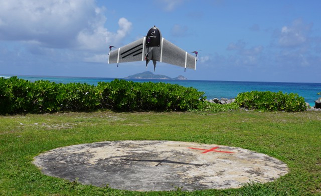
Marlyn takes off at silhouette to start a mapping mission
“The outdated and inaccurate map is our only means of planning and guiding expeditions. During our trips, we can encounter cliffs or impenetrable areas that are not shown on the current map, forcing us to abort the mission prematurely”, conservation officer at the Island Conservation Society, François Baguette explains. He goes on: “The high-resolution photographs and maps made by Marlyn will help us to better understand this area and will enable us to better plan our expeditions, saving us a lot of time and valuable manpower.”
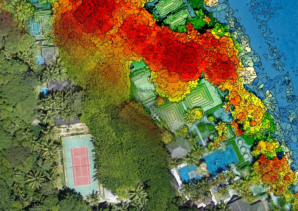
Layover of the elevation model over regular orthophoto
“With this project, we are seamlessly pursuing the vision of our company: empowering professionals across industries to effortlessly gather geospatial data from the sky, enabling them to make more informed decisions, more efficiently and effectively”, mentions Sander Hulsman, CEO of ATMOS UAV. He adds “Where all other hybrid drones quit, Marlyn continues. Her ability to withstand winds up to 6Bft during all phases of the flight from take-off to cruise and landing makes her a truly unique professional mapping tool that proved to be essential for this project. We are very proud that TFC International selected our flagship model Marlyn for this beautiful and challenging project.”
The combination of having only a handful of small take-off points in combination with the mountains, ever-present wind and heat makes mapping the Silhouette island a big challenge. Conventional drones that fly like helicopters lack the endurance and fixed-wing drones need a large empty space to take-off and land which is not available.
“When we found out about Marlyn’s unique ability to take-off and land vertically under windy conditions combined with a high flight autonomy, we knew this is exactly the drone we needed for this wonderful project”, says Jean-François Rossignol, director of TFC International. He continues: “As Marlyn has what it takes to map this island given the extreme conditions, I am confident she is capable of mapping any other project all over the world.”
Source: Press Release