
RUAS division has announced that it has recently partnered with Bangor University to work alongside them on a new project to map artificial and natural substrates at coastal locations across Wales.
Bangor University, founded in 1884 with a long tradition and pedigree in research, is a partner in the Ecostructure project, a consortium led by Aberystwyth University and including universities across Ireland and Wales. The project will raise awareness of eco-engineering solutions to the challenge of coastal adaptation to climate change. RUAS have joined them to help conduct a range of aerial mapping surveys at coastal locations in Wales where there is artificial hard substrate present, such as sea defences or coastal structures.
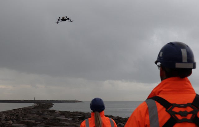
Working in close partnership, RUAS will provide high quality aerial imagery and associated topographical information for sites around the coast of Wales for Bangor University to analyse. Using both fixed wing and multirotor drones, the project has been timed carefully to make the most of near-Spring low-tides and to ensure maximum visibility of all coastal structures.
Andrew Davies from the School of Ocean Sciences at Bangor University says:
“RUAS offers a combination of state-of-the-art equipment and operational expertise that is required to collect data from forty different sites throughout Wales, in what is the largest high-resolution mapping exercise of coastal defence structures ever undertaken.”
Explaining the project Davies adds:
“Hard coastal defence structures are becoming commonplace on our coastlines due to rising seas and increasing storminess. The Ecostructure project is focused on raising awareness of eco-engineering solutions, and a first step is developing comprehensive maps and models of structures throughout the Irish Sea.”
The consortium is looking to support marine eco-systems, and it is hoped that this project will help to assist with such as the pipelines that jettison into the sea. These often contain a full and diverse eco-system which can, on occasion, block the pipe so it is hoped that this research will help to provide some further insight to these. This information can then be used to assist in changing materials or positions to minimise disruption to the pipeline whilst maintaining a healthy habitat for the creatures living within it.
Mark Jones, Head of RUAS says:
“We are pleased to have been appointed by Bangor University to be working with the School of Ocean Sciences. The use of unmanned aircraft (drones) to map ecostructures around the coastline of Wales will greatly enhance the scientific research capabilities for the project and we are delighted to showcase what drones can do in this field”.
About RUAS
Resource Group’s Unmanned Aviation Services division rebranded to RUAS effective as of 15th November 2017. The company is the longest standing accredited UK Civil Aviation Authority (CAA) National Qualified Entity (NQE) for Small Unmanned Aircraft (SUA) and is permitted to assess pilot competency for drones up to 20kgs and verify that organisations meet the UK CAA’s requirements to hold Permission for Commercial Operations (PfCO).
Source: Press Release