
General Atomics Aeronautical Systems Inc., Poway, California, has been awarded a $163,212,869 modification (P00119) to contract W58RGZ-13-C-0109 for MQ-1C Gray Eagle extended range supplemental production hardware. Continue reading

UAS VISION
an independent online news service for the Unmanned Aircraft Systems world
General Atomics Aeronautical Systems Inc., Poway, California, has been awarded a $163,212,869 modification (P00119) to contract W58RGZ-13-C-0109 for MQ-1C Gray Eagle extended range supplemental production hardware. Continue reading

Raytheon Co., McKinney, Texas, has been awarded a $29,776,287 firm-fixed-price contract for the purchase of 21 Common Sensor Payload systems to meet an increased production requirement of the Army Gray Eagle. Continue reading

Coalition airstrikes killed three senior and highly skilled Islamic State of Iraq and Syria officials near Mayadin, Syria, Sept. 12-14, Combined Joint Task Force Operation Inherent Resolve officials reported. Continue reading
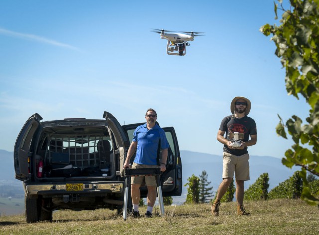
Michael Wing, director of Aerial Information Systems Laboratory at OSU , left, and doctorate student Cory Garms – Andy Cripe – Gazette-Times
Since he began using unmanned aircraft in his research in 2012, Oregon State University forestry professor Michael Wing has seen many ways a flight can go wrong. Once, in August, he even had a turkey vulture threaten to attack a quadcopter he was using; the bird came within about 15 feet of the vehicle, he said. Continue reading

Embry-Riddle Aeronautics University used a small unmanned aircraft system (UAS) to study the effects of wind turbines on farmland beneath them and found that they can impact soil, crops and livestock. Continue reading
At the Joe Nall Week NOON SHOW 2017, Andreas Gietz flies his giant B-2 Spirit Continue reading
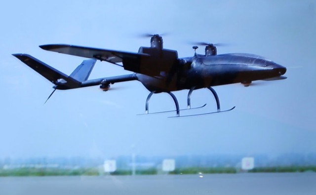
Urban aerial surveillance capabilities are already seen as a crucial element in the information mosaic required for any smart city of the future, and last week’s TM Forum Smart City In Focus Conference in Yinchuan (China) saw the first showing of an Unmanned Aerial System that has been purpose-built for the task based around quite groundbreaking capabilities. Continue reading

DELAIR introduced its next-generation professional unmanned aerial vehicle (UAV) for survey-grade photogrammetric mapping, the UX11, at INTERGEO 2017 on September 26th in Berlin, Germany. This small fixed-wing UAV combines a powerful integrated onboard system, industry-grade sensors, limitless communication range and PPK centimeter-level positioning. Continue reading