
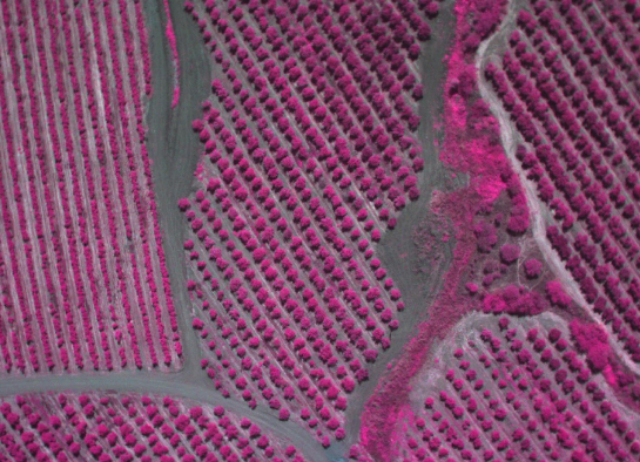
IDETEC Unmanned Systems and the University of Talca (Chile) have conducted an operation to evaluate the benefits of AG-Wing unmanned aerial system in Olive crops. The system has collected multispectral geo-referenced images over a zone in the south of Chile. The operation was conducted on March 13, 2014.
Since the appearance of AG-Wing, at the end of 2013, the system has been delivered to four countries. AG- Wing system includes multispectral image payload and image process software, delivering a complete solution for precision agriculture and mapping.
“We are planning to develop a mathematical algorithm to estimate water requirements of orchards and vineyards using AG-wing equipped with thermal and narrowband multispectral imaging sensors. We hope this new technology can be a potential tool for applying the site-specific irrigation management with the aim of improving water use efficiency and optimizing olive oil and yield” Dr. Samuel Ortega-Farias, University of Talca, Chile.
“Once again, we have confirmed that AG-Wing is the best sUAS for agriculture, it is easy to launch and recover in small areas, capable to handle winds and the most important thing… It can cover up to 600 Acres per flight equipped with the correct payload to obtain multispectral NIR images, NDVI maps and thermographic data” says Juan Sainz, IDETEC Unmanned Systems, President & CEO.
Source: Press Release