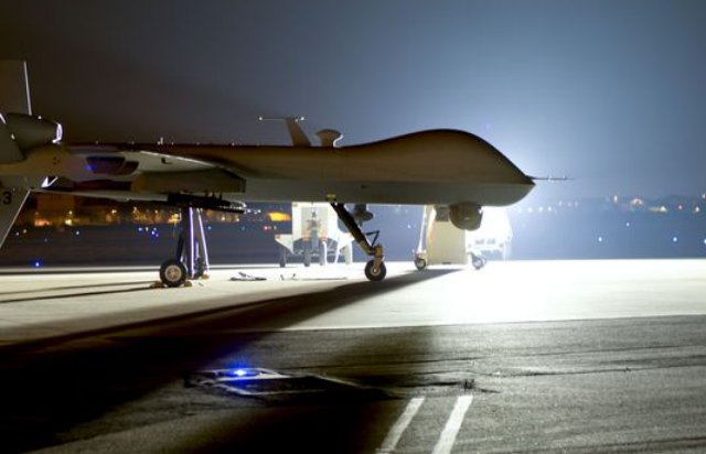
Missions for the Army and Air Force are unique enough that the services will likely need to fly their own separate unmanned platforms for the foreseeable future, according to service leaders. Continue reading

an independent online news service for the Unmanned Aircraft Systems world
Missions for the Army and Air Force are unique enough that the services will likely need to fly their own separate unmanned platforms for the foreseeable future, according to service leaders. Continue reading
![]() Dedrone, a leading drone detection technology company, has announced the next generation of its drone warning system. The DroneTracker 2.0 detects unmanned aerial vehicles based on their WLAN signals, allowing for identification of drone models and even individual devices.
Dedrone, a leading drone detection technology company, has announced the next generation of its drone warning system. The DroneTracker 2.0 detects unmanned aerial vehicles based on their WLAN signals, allowing for identification of drone models and even individual devices.

SimActive Inc., a developer of photogrammetry software, has announced the purchase of its Correlator3D software by GeoFIT Americas, a subsidiary of Groupe FIT. The software is used for image processing from UAVs in sizeable mapping projects. Continue reading

A near miss between a drone and a Lufthansa aircraft landing at Los Angeles International Airport may give impetus to moves to regulate consumer drones more closely, including by using technologies like geofencing. Continue reading
Spring in the Nation’s Capital brings with it the extraordinary beauty of the cherry trees blooming around the Tidal Basin. At the Federal Aviation Administration (FAA), we want you to shoot all the photos and video you want – but leave your drone at home. Continue reading
Researchers at the Johns Hopkins University Applied Physics Laboratory in Laurel, Maryland, have developed an innovative unmanned aerial vehicle (UAV) that can stay on station beneath the water, then launch into the air to perform a variety of missions. Continue reading
A Colorado-based private airline management and charter company has expanded into the unmanned aircraft systems industry. Mountain Aviation has announced it received a U.S. Federal Aviation Administration section 333 exemption to commercially operate UAVs through services tied to aerial mapping, agriculture support, industrial inspections, aerial video, search and rescue, energy system inspections and forestry monitoring. Continue reading
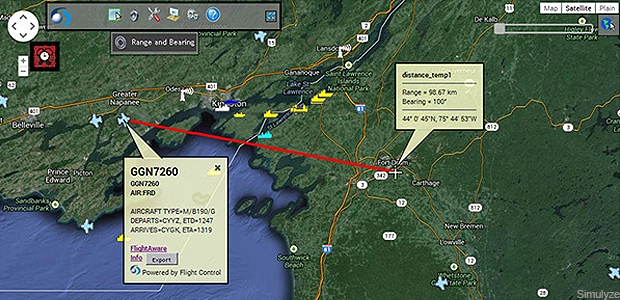
One of the biggest stumbling blocks to widespread unmanned aerial systems operation is situational awareness, especially in the United States, which has the busiest airspace in the world. One company, however, argues that providing situational awareness is just a big data and analytics challenge. Continue reading