
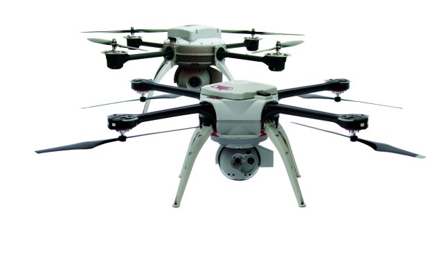
 Aeryon Labs has introduced Map Edition bundles for Aeryon small Unmanned Aircraft Systems (UAS). This new bundled option, available for both the Aeryon Scout and Aeryon SkyRanger, is designed for any application that requires survey-grade accuracy orthomosaics, Digital Surface Models (DSMs) and point clouds from aerial or oblique imagery – and seamless integration with GIS, CAD, and traditional photogrammetry software. Continue reading
Category Archives: VTOL
Flying Robot Dance – Video
KMel Robotics and Yuneec International announce their collaboration on a family of aerial photography aircraft with this video, unveiled at CES 2014. Continue reading
Indian Police Deploy UAS to Trace Kidnappers
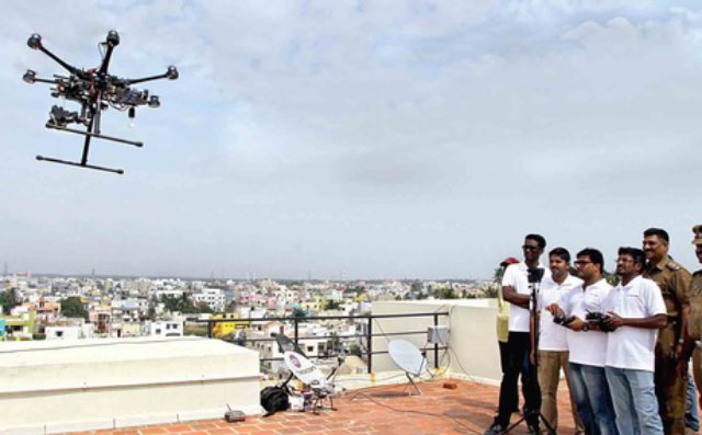 For the first time ever, the Pondicherry Police on Wednesday employed a UAS to try and crack a kidnap case. The “multicopter” was used to trace the house in which 10-year-old Neeraj Jain, son of Manish Kumar Jain, was held captive in December. Continue reading
Belgian School Tests DJI Phantom to Stop Exam Cheats
The Thomas Moore College in Belgium is experimenting with using remote controlled UAS to catch students cheating on their tests. Continue reading
Black Night Transformer – Unmanned Helicopter/Truck
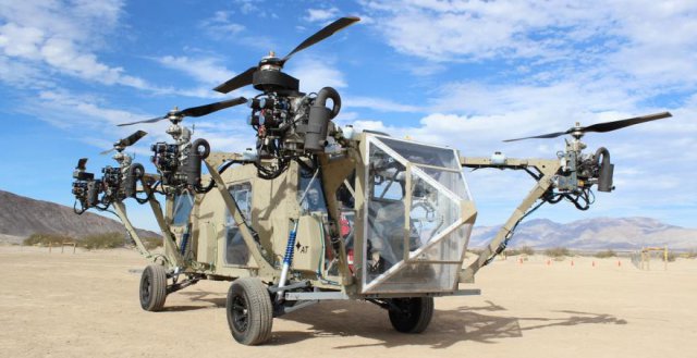 Advanced Tactics Inc., a small aerospace company, released details about its AT Transformer vehicle technology and announced that a full-scale technology demonstrator has completed its first driving tests.The AT Transformer technology makes possible the world’s first roadable, vertical takeoff and landing (VTOL) aircraft. Continue reading
Photo Service Cooliris Brings Real-Time UAS Photos to User Groups
 US-based photo service Cooliris wants to bring dramatic aerial photos instantaneously into the hands of consumers via private groups so users can share them on their iPhones or iPads. Cooliris has announced a partnership with UAS manufacturer Aibotix, becoming the first consumer photo application to integrate with UAS. Continue reading
Bordeaux Classified Vineyards Invest in UAS Technology
 Bernard Magrez is to roll out newly-developed vineyard UAS in his four classified Bordeaux estates – Pape Clement, La Tour Carnet, Fombrauge and Haut Peyraguay – before eventually extending them to his entire portfolio of Bordeaux properties, and those in the south of France. Continue reading
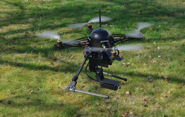
What Makes the Quadcopter Design So Great for Small UAS?
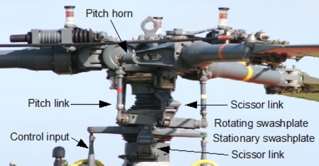 There are many misconceptions surrounding quadcopters and multirotors. The single main reason that they are popular for small UAS is mechanical simplicity. It’s worth pointing out that a quadcopter is LESS stable than an equivalent regular helicopter (and I’ll explain why in a sec), and is also LESS efficient than an equivalent regular helicopter. Continue reading