
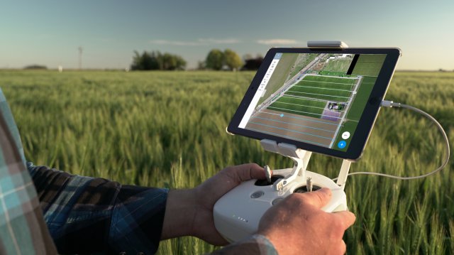
 DroneDeploy has announced the beta release of its new Fieldscanner product offering real-time drone mapping, just in time for the spring growing season. With Fieldscanner, available as part of DroneDeploy’s iOS app, farmers can use any DJI drone to create a map of their fields as the drone flies so that they can view insights before it lands.
Category Archives: Software
Trumbull Uses SimActive for Emergency Response
SimActive Inc. has announced that Trumbull Unmanned is using Correlator3D as part of their emergency response services. This includes rapid mapping of oil spills and pipeline inspections for large surveys. Continue reading
New Software Simplifies Oil and Gas Inspections
 Industrial Skyworks has announced the official launch of Blue VU advanced software for the accurate and efficient inspection of buildings, and oil and gas infrastructure. Industrial Skyworks’ new Blue VU software will relieve inspectors, engineers and technicians from sifting through thousands of images while providing safe visual access to hard to reach locations, such as the roofs of buildings, flare stacks, and storage tanks.
MQ-4C Triton Improves Mission Capability with Software Upgrade Test
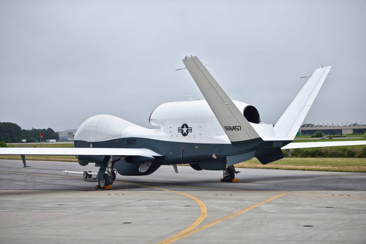 The U.S. Navy’s MQ-4C Triton, built by Northrop Grumman Corporation (NYSE: NOC), completed formal lab testing and a successful first flight of an improved software suite that enhances the autonomous unmanned system’s operational capabilities and enables Early Operational Capability (EOC) deployment in early 2018. Continue reading
New Report Reveals Drone Industry Trends Across 160 Countries

DroneDeploy revealed its third Commercial Drone Industry Trends Report, representing analysis of more than 10 million acres mapped by drone users in more than 160 countries across all seven continents. The original report, released a year ago, provided the first insight into global trends in commercial drone use based on real-world mapping data. Continue reading
New Google Earth Video Extension from Remote GeoSystems
Remote GeoSystems, Inc. has announced the release and availability of the all new LineVision Google Earth Extension – commercial software for UAV, airborne & terrestrial mobile inspection and survey projects requiring geo-referenced video playback, analysis, collaboration and reporting using Google Earth & other GIS applications. Continue reading
Evans Launches Human-Centered UAS Solutions Suite
![]()
Evans Incorporated, a provider of Human-Centered consulting solutions, has announced the launch of its comprehensive CAARMA Unmanned Aircraft Systems (UAS) Solutions Suite. The CAARMA UAS Solutions Suite delivers significant value to users across the aviation industry in its ability to safely and effectively expand the use of UAS within the government and commercial sectors. Continue reading
SimActive and Tianlifa Launch Integrated UAV Solution
SimActive Inc. has announced a fully-integrated solution with Tianlifa, a major firm in the Asian surveying market for over 20 years. The partnership results in a high-end mapping product featuring the new China Star drone from Tianlifa and SimActive’s Correlator3D. Continue reading