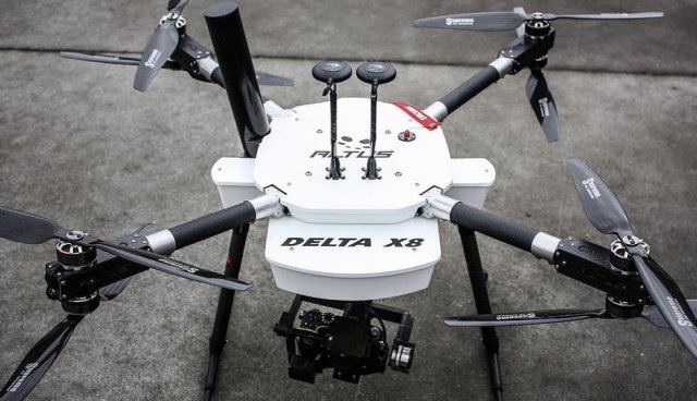
CNN has acquired a Delta X8, a multi-rotor designed and manufactured by New Zealand-based Altus Unmanned Aerial Solutions, to advance its efforts to employ unmanned aircraft for their aerial news-gathering over public and property. Continue reading

UAS VISION
an independent online news service for the Unmanned Aircraft Systems world
CNN has acquired a Delta X8, a multi-rotor designed and manufactured by New Zealand-based Altus Unmanned Aerial Solutions, to advance its efforts to employ unmanned aircraft for their aerial news-gathering over public and property. Continue reading

Strat Aero PLC an international aerospace company focused on the rapidly emerging Unmanned Aerial Vehicle sector, announced that it has entered into a Share Purchase Agreement for the acquisition of Geocurve Holdings Limited, a privately owned company, which specialises in the provision of UAV operated topographical surveys and inspection services to a blue chip customer base, including the UK’s Environment Agency, EDF Energy, Carillion, and the RSPB. Continue reading
Mission Statement: The mission of the UAS Insurance Association is to assist the insurance industry in establishing and maintaining practices and procedures focused on the growing world of UASs in commercial operations and insuring that the unique interests and perspectives of the insurance industry associated with UAS are identified and effectively managed through insurance and other techniques of risk mitigation. Continue reading
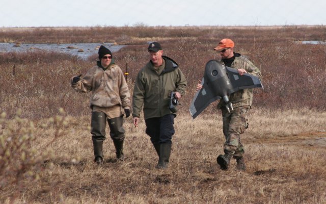 In a portion of Manitoba, Canada, so remote you have to fly in by helicopter, a research team led by the University of North Dakota and the American Museum of Natural History spent the summer in the polar bear capital of the world deploying the latest tool – Unmanned Aerial Systems (UAS) — in a nearly five-decade-old ecological study.
![]()
The Small UAV Coalition, which is pressing for relaxed regulations for the use of commercial UAVs, hired its first outside lobbyist this week. Continue reading
Denver International Airport and the Federal Aviation Administration (FAA) are partnering to raise awareness about safe unmanned aircraft operations. Continue reading
 Small unmanned drones are now part of the tools used by the prison service to battle the practice of throwing drugs and contraband over the perimeter fence of HMP Northward, and it appears likely that they will also be used in the near future by the RCIPS, especially to help the Joint Marine Unit with search and rescue operations.
Supplied by local company AirVu, the small unmanned aircraft (SUAs), which are outfitted with cameras, can be very quickly deployed at the prison and used to identify the perpetrators hurling things over the fence before they run into the bush, according to Prison Director Neil Lavis. Continue reading
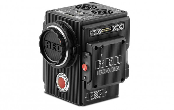
RED has unveiled its new RAVEN camera, offering 4K recording at up to 120fps, 2K at up to 240fps, and 2K ProRes up to 60fps. Continue reading