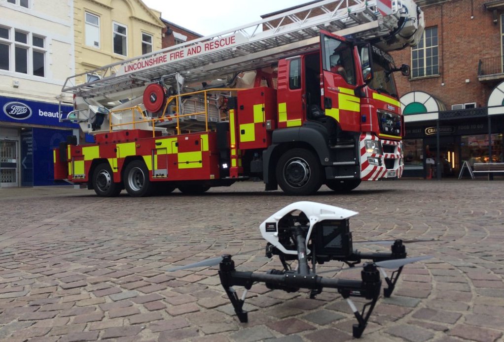
Kongsberg Geospatial, an Ottawa-based developer of real-time, mission critical, geospatial visualization software, and the County of Renfrew Paramedic Service announced today the successful conclusion of field trials of a new software application developed to improve the safety of operating a search-and-rescue drone beyond visual line-of-sight (BVLOS). Continue reading
Category Archives: First Responders
3D Crime-Accident Scene Drone System
With this combination of advanced imaging software and the latest in unmanned aerial vehicles, agencies can rapidly map crime-accident scenes, and simultaneously gather more information than other traditional technologies. Conservatively, even large scenes can be documented in less than 30 minutes and because the system easily fits in the trunk of a car, there is no need to wait for ladder trucks, or manned aviation.
Shark Hunting UAVs in Australia
High-Tech UAVs developed by Australia’s first astronaut and a philanthropist whose friend was killed by a shark are to patrol NSW’s coast, spotting great whites and other man-eaters. Continue reading
UAS Learn to Navigate Forest Trails in Switzerland
In Switzerland emergency centres respond to about 1,000 to calls about hikers lost or injured in the forests annually, according to the University of Zurich. But research the university has completed, in collaboration with Università della Svizzera italiana and the University of Applied Sciences and Arts of Southern Switzerland, may help speed up the search and rescue process.
Austin Fire Department Robotics Emergency Deployment Team
The Austin Fire Department is embarking on a pilot project together with leaders in research and industry to explore the feasibility of the use of robotics in real-time emergency incident management. The goal is ultimately to enhance firefighter safety and the effectiveness of the emergency response capabilities it provides to its citizens. Continue reading
Russian Emergencies Minister Opens Unmanned Aviation Centre
Russia’s emergencies ministry on Sunday opened an unmanned aviation centre at the ministry’s Moscow region department. The ceremony was attended by Minister Vladimir Puchkov.
“The unmanned aviation center will help improve the quality of monitoring and raise the level of crisis response,” he said. The minister said drones would be used for aerial surveying to establish precise coordinated of emergency situation, damaned facilities, epicenters of wildfires and man-caused fires. Apart from that, in his words, drones would be used to monitor the flood situation and ice cloggings. Continue reading
Austin Fire Department Shows Off UAS Team
Austin Fire Department is showing off one of their new tools — aimed at helping keep people safe – their unmanned aerial vehicle, more commonly known as a “drone.” Since drones are a popular holiday gift item, they say it’s important to know the rules beforehand, and check with the FAA. Continue reading
Add-on Scans Disaster Zones to Locate Survivors
A technology firm has developed a small robot module that clips on to any small drone and can be used to search for survivors from the air in a disaster zone. Continue reading
