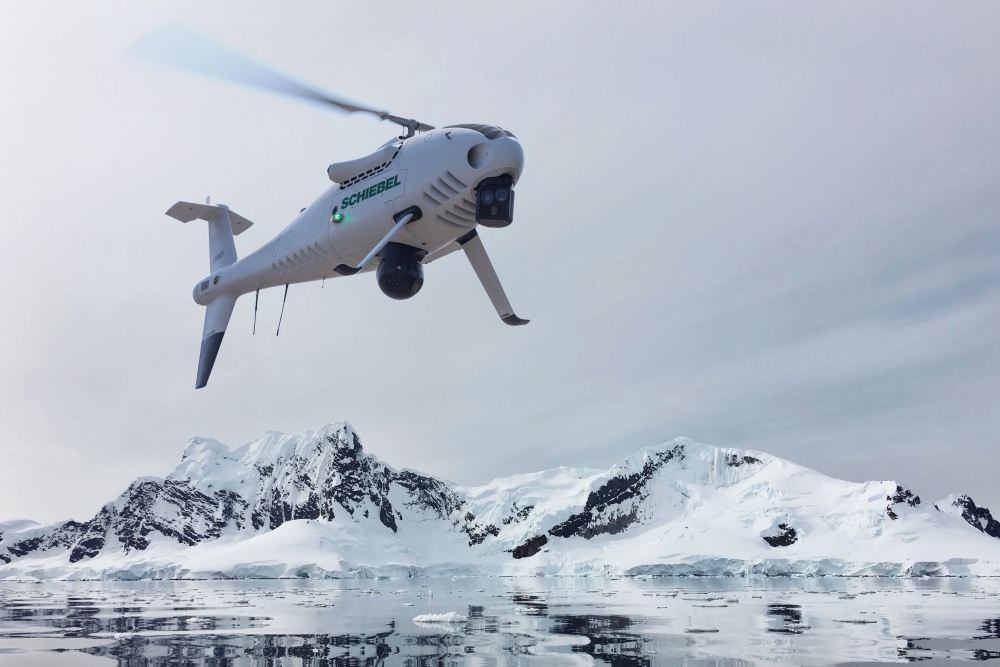
Norway’s Andøya Test Center selected Schiebel’s market- leading CAMCOPTER S-100 Vertical Takeoff and Landing (VTOL) Unmanned Air System (UAS) for extensive search and rescue trials as part of the Arctic 2030 project. Continue reading

UAS VISION
an independent online news service for the Unmanned Aircraft Systems world
Norway’s Andøya Test Center selected Schiebel’s market- leading CAMCOPTER S-100 Vertical Takeoff and Landing (VTOL) Unmanned Air System (UAS) for extensive search and rescue trials as part of the Arctic 2030 project. Continue reading
Drone Solutions is introducing innovative Unmanned Search and Rescue (“USAR”) techniques, programs and services from its operational base in Singapore to cover the Ring of Fire where earthquakes, floods, volcano, cyclones and tsunamis occur daily; in the not too distant future coverage will be extended to also include Korea and Japan. Continue reading
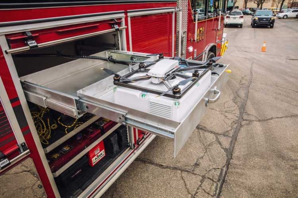
Fotokite recently announced the launch of a new product for firefighters in partnership with Pierce Manufacturing. Pierce Situational Awareness Systems by Fotokite are actively tethered unmanned aerial systems (UAS) integrated directly into public safety vehicles and firefighter operations. Continue reading

At its Annual Media Conference, Rega presented a new type of aircraft for searching for missing persons: the newly developed Rega drone can autonomously scan large search areas and is equipped with various sensors, such as a thermal camera. As a result, in future, Rega will have at its disposal an additional device to help it search for people in distress.
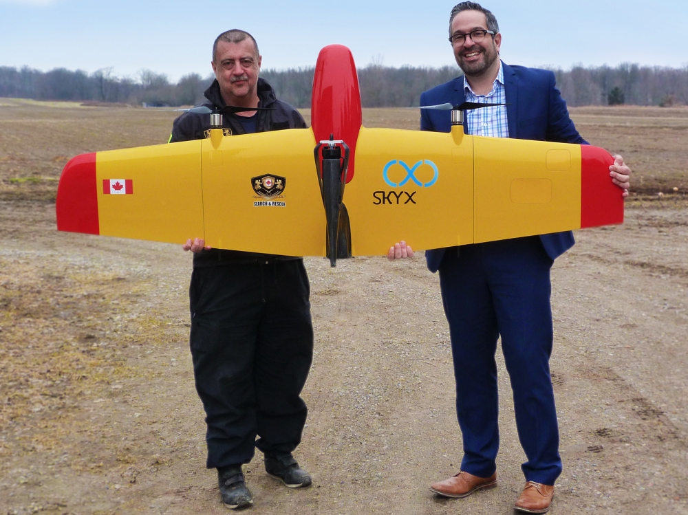
SkyX Systems, an aerial monitoring solutions provider, has announced that Advanced Tactical Training Search & Rescue Division (ATTSAR) is using SkyX aerial systems for long-range search missions, far surpassing the distance that most drones on the market can deliver. Continue reading
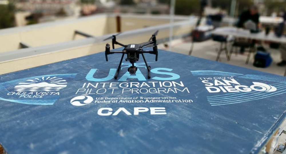
Cape, a cloud platform for drone telepresence and data management, has announced the Federal Aviation Administration (FAA) has granted the first-ever Certificate of Authorization (COA) with a provision for Beyond Visual Line of Sight (BVLOS) for a public safety organization. Cape worked closely with the FAA, and in partnership with the Chula Vista Police Department and Skyfire Consulting, to finalize the COA, which will open the doors for future drone integration across industries. Continue reading
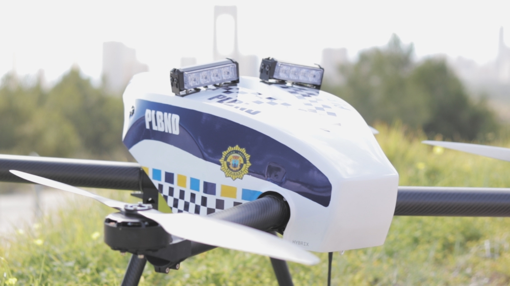
HYBRiX drone, the first hybrid fuel-electric multirotor with 10 times more flight time than electric drones, is now the subject of collaboration between the company and Benidorm City Hall to start one of the pioneer First-Response drone services worldwide. Continue reading
Dan Mark, a lieutenant for the city of Aurora Police Department in Colorado, has attended countless conferences during the 34 years he has been a police officer, but says he is a big fan of the summits put on by Foundation Research Associates (FRA). That’s why he has agreed to co-chair the Public Safety Technology Summit, Feb. 27-28, at The Mayfair at Coconut Grove. Continue reading