
Deep in New Zealand’s dairying heartland, drone maker Aeronavics tests aircraft designed to corner the fast-growing emerging market for unmanned aerial vehicles in the film and television business. Continue reading
Category Archives: Aerial Photography
Lily Offers a Self-Flying Camera
The Lily quadcopter flies itself and can follow you at speeds of up to 25 miles per hour at a height of 10 to 30 feet. But Lily also has packs a nice camera that captures high-definition video (1080p at 60 frame per second). The Menlo Park, Calif.-based startup, Lily Robotics, doesn’t see itself as competing with drone makers like DJI. Instead, it wants to take on action sports camera maker GoPro. Continue reading
Drone Images Aid Rescue Workers in Nepal
Relief workers in quake-stricken Nepal say they are using drones and crowdsourced maps offered by volunteer groups as they seek to get emergency supplies to stranded survivors. Continue reading
First-ever Ultra HD Phantom Flex4k Drone Footage
Brain Farm paired a Phantom Flex4K with an Aerigon UAV to shoot the world’s first Ultra High Definition, 4K aerial drone footage. The combination is a cinematic game changer. Continue reading
Game of Thrones Bans Drones
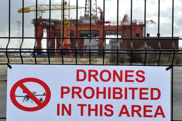 Crafty Game Of Thrones fans have been thwarted from getting any sneak behind-the-scenes peeks after a ban on drones above the set. Signs erected close to the filming studios in Titanic Quarter, East Belfast, warn of a “no-fly zone” . Continue reading
BBC Flies DJI Phantom in Crossrail Tunnel
For the first time, the BBC has been allowed to fly a remote controlled camera along the tunnels of Crossrail, the giant building project that will eventually see trains criss-crossing London and the South East on a brand new train line. Continue reading
Ship-Based UAV Ice Monitoring Mission in Arctic
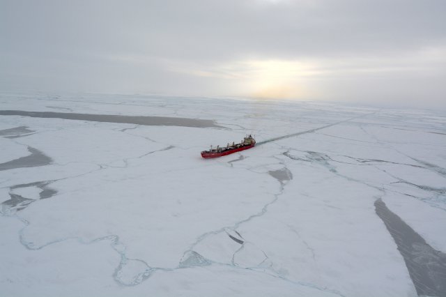 ING Robotic Aviation, Canada’s leading provider of robotic aircraft solutions, has just completed its two week mission to Canada’s North on board Fednav’s ice-breaking cargo ship MV Arctic. Primarily a research and development initiative, this project (led by Enfotec) was designed to assess various operational and technical aspects of ship-based UAV ice monitoring.
UAVs to Map Africa’s Unmapped Rural Areas
Ivan Gayton with Doctors Without Borders in London has created a low-cost drone which he says says will help map parts of Africa where infrastructure is poor — one of many new ways drone technology is being used in Africa. Continue reading