
– Volatus Aerospace Inc., a supplier of advanced aerial solutions, and Kongsberg Geospatial a recognized innovator in geospatial software and situational awareness solutions, have announced a new collaboration to enhance Beyond Visual Line of Sight (BVLOS) capabilities for Remotely Piloted Aircraft Systems (RPAS) through the integration of Kongsberg’s IRIS Terminal into Volatus’ state-of-the-art Operations Control Center (OCC). Continue reading
Category Archives: BVLOS
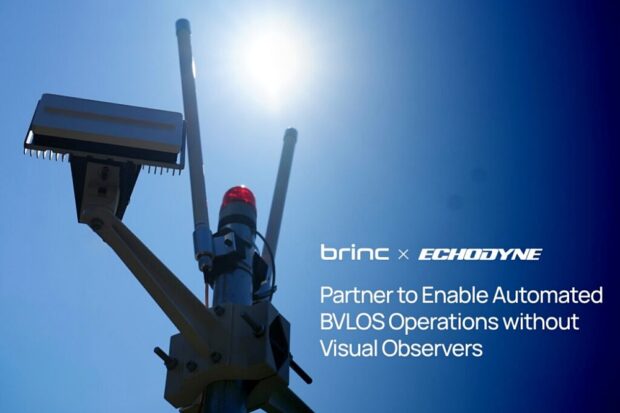
BRINC and Echodyne to Enable Automated BVLOS Operations for First Responders
BRINC, a supplier of drone technology for first responders, has announced a partnership with Echodyne, a manufacturer of ground-based radar systems. This collaboration will integrate Echodyne’s advanced MESA radar technology into BRINC’s purpose-built Drone as First Responder (DFR) solution. Continue reading
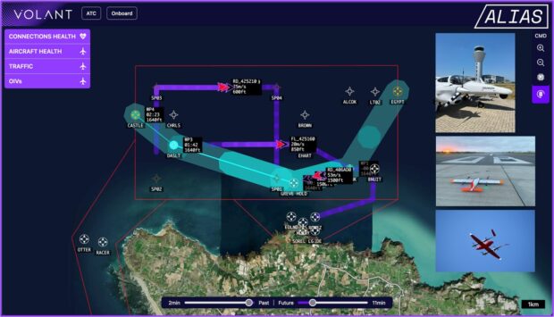
uAvionix FlightLine Surveillance Services Integrates with Volant Autonomy’s Integrated Traffic Management
uAvionix, a supplier of aviation surveillance solutions, has announced the integration of its FlightLine surveillance services with Volant Autonomy’s advanced ITM (Integrated Traffic Management) system for ALIAS (Agile and Integrated Airspace System), a leading-edge UK Government $5M Future Flight Phase III project. Continue reading
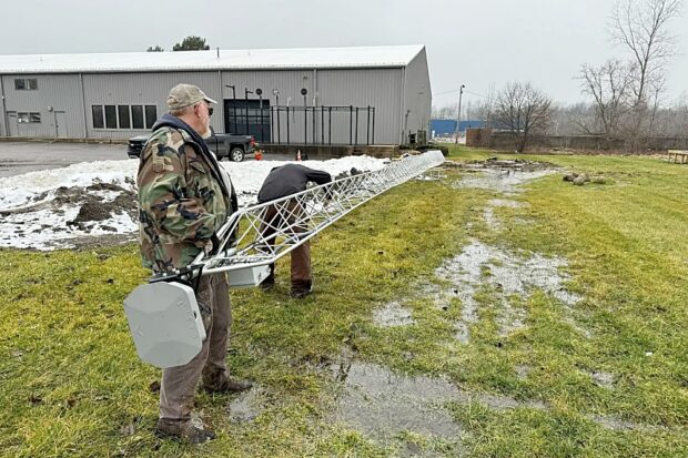
Unmanned Vehicle Technologies and uAvionix Announce FAA BVLOS Waiver for Michigan Test Site
UVT and uAvionix have jointly announced that Unmanned Vehicle Technologies, LLC has received a Federal Aviation Administration (FAA) waiver to operate small unmanned aircraft systems (sUAS) Beyond Visual Line of Sight (BVLOS) at their test site in Michigan. This waiver, granted under Part 107 regulations, allows UVT to significantly advance operational capabilities, opening new avenues for remote enterprise applications. Continue reading
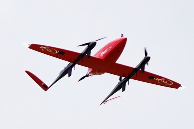
RigiTech’s Eiger Drone Completes First BVLOS Flights in the US with Upstate Medical University
.RigiTech has announced a significant milestone in the United States, after completing the first flight Beyond Visual Line of Sight from the pilot (BVLOS), in partnership with Upstate Medical University’s Air Upstate drone program and Causey Aviation Unmanned, marking a crucial advancement in the transport of time-sensitive medical materials. Continue reading

MatrixSpace Gets $1.25M AFWERX Open Topic SBIR Contract to Develop Low SWAP-C Multi-Function Payload
MatrixSpace has been selected by AFWERX for a $1.25M Direct-to-Phase II SBIR to develop a prototype low SWaP-C multi-function, multi-band antenna payload, based on the MatrixSpace Radar hardware platform. Continue reading

FAA Approves BVLOS Drone as First Responder Program in New York State
uAvionix, a provider of command, navigation, and surveillance technologies for drones, has announced that the Oswego City Police Department’s Drone as a First Responder (DFR) program has received Federal Aviation Administration (FAA) approval for operations Beyond Visual Line of Sight (BVLOS) without Visual Observers (VOs) using the uAvionix Casia G ground-based detect-and-avoid (DAA) system. Continue reading

dronePORT Hamburg Opens Using HHLA Sky Technology
As part of the recent dronePORT opening in Hamburg, HHLA Sky, a subsidiary of Hamburger Hafen und Logistik AG (HHLA), presented its solutions for efficient drone operations in Hamburg. The dronePORT Hamburg is the first location for unmanned aviation and mobile sensor technology and was opened on June 14th. by the Hamburg Port Authority (HPA), the Hamburg Police and Hamburg Aviation. Continue reading