
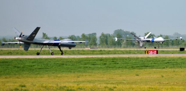
 The 319th Operations Support Squadron supported a milestone in unmanned aerial vehicle aviation Aug. 1. For the first time, the Federal Aviation Administration authorized two UAVs to operate simultaneously in a traffic pattern of unrestricted airspace.
Category Archives: Applications & Testing & Experience
Seeker 400 Completes Second Round of Flight Tests
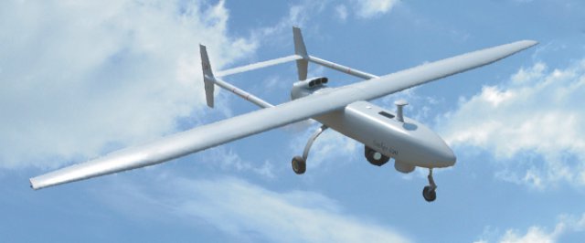 The Denel Dynamics Seeker 400 unmanned aerial vehicle has successfully completed a second round of flights tests at Alkantpan in the Northern Cape as part of its development process, Denel has announced. The tests included an evaluation of the system for range and performance with full payload on board.
Hummingbirds Hover Better than Black Hornet
When it comes to flight, nature just has the edge on engineers. This is according to a study comparing hummingbirds with one of the world’s most advanced micro-helicopters. Researchers found that – in terms of the power they require to lift their weight – the best hummingbird was over 20% more efficient than the helicopter.
UAS as Construction Inspectors
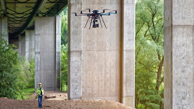 The small craft, barely a metre across, works its way up to the 11th floor, examining the façade for such damage as chipped or crumbling concrete, defective joints and the like. Keeping about two metres from the façade, the robot is on an inspection tour of the building. It’s equipped with a high-resolution digital camera that takes detailed images of each part of the building. In this case, the work is being done in Saarbrücken, Germany, and the operator is Christian Eschmann, a researcher at the Fraunhofer Institute for Non-Destructive Testing.
Further Flight Testing for Seeker 400 and Hungwe
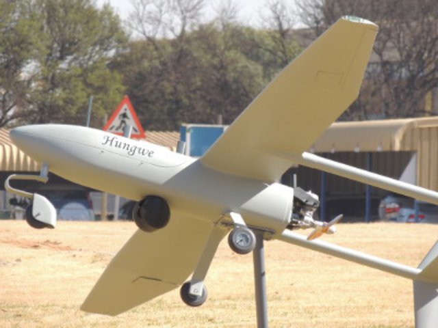 Denel Dynamics is continuing with flight testing of its Seeker 400 and Hungwe military and civil unmanned aerial vehicles (UAVs) ahead of serial production.
Can UAS Save Namibia’s Wildlife?
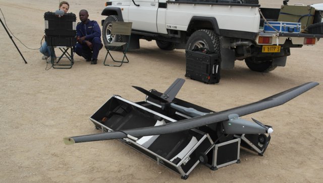 In the span of less than two years, Joe Noci and his wife, Gisela, went from working in the aeronautical drone industry in South Africa to building conservation drones out of their home in Namibia. Their SurVoyeur drones, which the Nocis design and build from scratch, have proven to be effective anti-poaching tools. As a result, Joe now finds himself on the front lines of anti-poaching work in Namibia
Selex-ES Asio and Spyball UAS Ready for Delivery to Italian Army
 Finmeccanica – Selex ES’s ASIO-B and SPYBALL-B UAVs have passed their factory acceptance tests, leaving them ready for delivery to the Italian Army for its Forza NEC modernisation programme.
ING Robotic Aviation and ASG Mapping use Robotic Aircraft for Advanced Agricultural Data Gathering
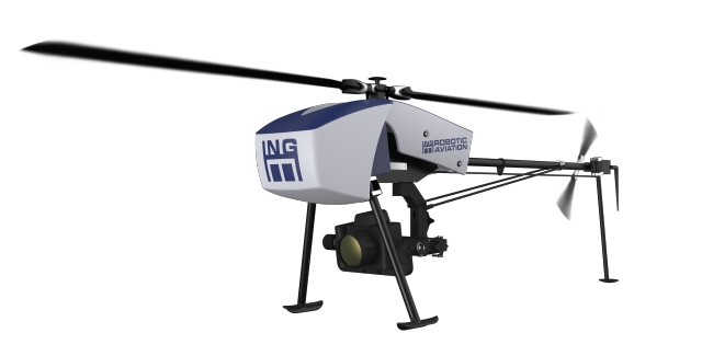 ING Robotic Aviation is partnering with ASG Mapping to rigorously assess and develop the application of small robotic aircraft systems for gathering high quality, positionally accurate, and interoperable geospatial data.