
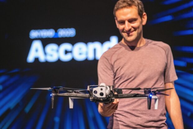
Skydio has launched Skydio X10, a drone designed for first responders, infrastructure operators, and the US and allied militaries around the world. It has the sensors to capture every detail of the data that matters and the AI-powered autonomy to put those sensors wherever they are needed.
It packs more capability and versatility in a smaller and easier-to-use package than has ever existed.
This drone is the culmination of everything we’ve learned over the past ten years delivering over 40,000 intelligent flying machines and serving over 1,500 enterprise and government organizations. It’s the first drone that we’ve designed from the ground up with full insight into the needs of our most demanding professional users in some of the most high-stakes scenarios. For the first time, world-class hardware – sensors, modularity, connectivity – is coming together with the autonomy Skydio is known for – taking a huge leap forward thanks to 10x increases in onboard compute power and navigation camera resolution – in an airframe that can go from a backpack to airborne in less than 40 seconds.
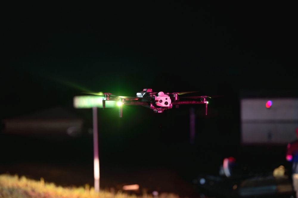
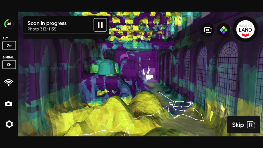
X10 fits right into existing drone operating procedures, but it also opens up a future of more scalable operating paradigms: 24×7 operations with NightSense autonomous flight in zero-light environments, fully automated data capture with 3D Scan, flight control by web browser from anywhere in the world via onboard 5G and Remote Flight Deck, and 1-operator-to-many-drone controls. We built these capabilities because we envision a world where drones themselves become basic infrastructure, providing a perfect digital picture in real time of the things that matter most to those who need it.
X10 brings these possibilities to life today. For example:
- Using drones to respond to 911 calls – a concept known as Drone as First Responder or DFR – will have a transformative impact on public safety. X10 is the perfect tool to get started with DFR. The X10 can be launched on scene by officers on patrol, just as they do today, but then taken over and flown remotely, providing real-time aerial support to those on the ground, and enabling agencies that deploy it to start leveraging remote operations.
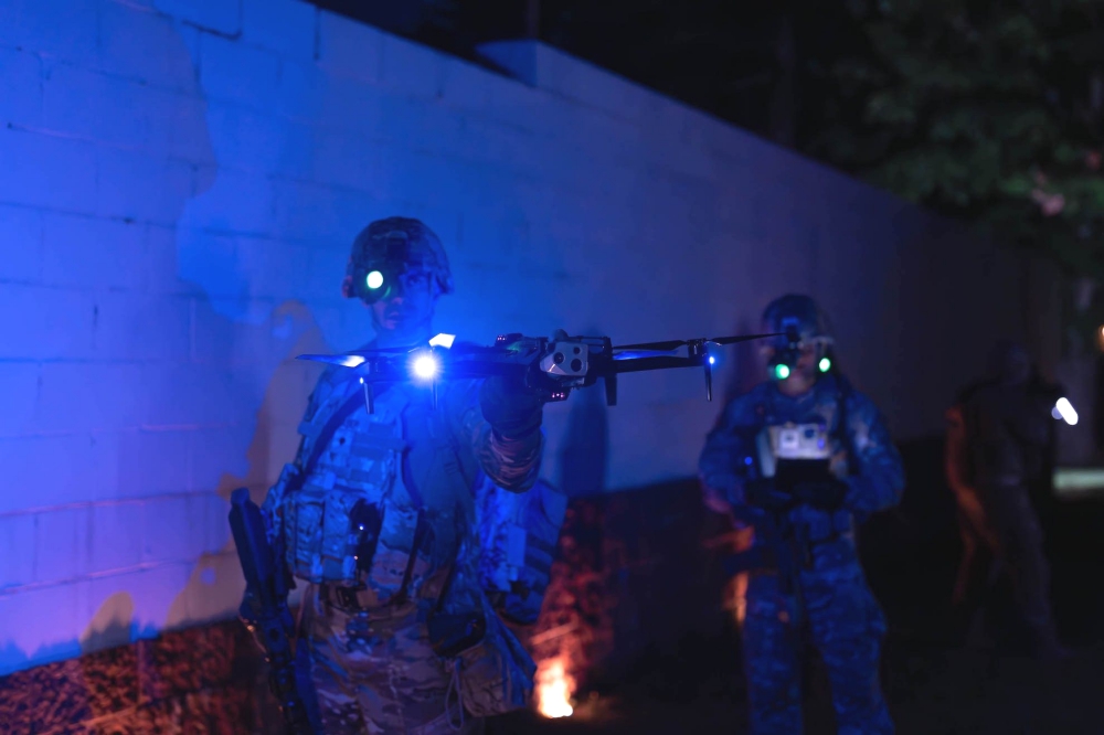
- Ukraine’s courageous defense against Russia’s invasion has illustrated how critical drones are, but it’s also demonstrated that on a modern battlefield GPS and radio link jamming are the norm. Small, smart, and survivable drones are the antidote. X10D (a model available exclusively for military operators and federal agencies) features a multi-band radio with dynamic frequency selection making it link jamming-resistant, and its visual navigation system means that it can fly fully autonomously without GPS.
- Critical infrastructure operators from State Departments of Transportation to Telecommunications companies to Energy Utilities have started using drones to inspect their assets. X10’s onboard AI and autonomy lowers the training barrier, enabling anyone in the organization to take full advantage of X10’s best-in-class sensors to detect everything from a 0.1mm crack in concrete to a failed solar cell via thermal inspection.
As drones have become increasingly important for critical industries, it’s also become increasingly clear that we can’t rely on systems beholden to the policies of foreign adversaries. Skydio started investing in US-based manufacturing capacity in 2016 at a time when many had written off the possibility of a US-drone company, let alone one manufacturing in the US. We’re proud to be building X10s at our 37,000-square-foot Hayward, CA facility, and we are confident that X10 answers the question of whether a US company can deliver. Organizations adopting X10 will be taking a significant step forward in capability, toward the future of the industry, while also taking a big step forward in security.
Today we’re also announcing Skydio Extend – a set of APIs, workflows, and integrations that make Skydio an open platform and deliver end-to-end solutions for customers with partners like Axon, ESRI, and Trimble.
Source: Press Release