
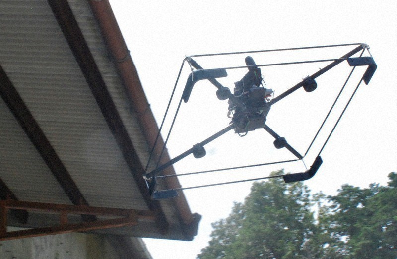
The “seamless drone” created by developers in Kyoto Prefecture is seen entering a warehouse that does not have GPS signal reception in the prefectural city of Nantan, on July 20, 2020
A business venture in western Japan has developed a drone that can be operated on autopilot in places with no GPS reception, such as below girder bridges or in tunnels — a promising device for infrastructure maintenance.
The “seamless drone” was created by Earth Analyzer, a startup based in the city of Ayabe, Kyoto Prefecture. The drone receives location information from sensors set up around places with no GPS signals, which is converted into the same kind of signals used in GPS. This enables the drone to automatically identify its location.
The first demonstration flight was unveiled on July 20 at a warehouse of a construction company in the Kyoto prefectural city of Nantan.
Once the command to takeoff was given to the drone on standby outside the warehouse, the device floated in the air as its four propellers made a humming noise. The drone flew to the entrance while following a course along ribbons that were strung outside the warehouse, just as it had been programmed to do, and hovered for a moment.
Then, a change was made to the system so that the source of location information transmitted to the drone was switched from GPS to a group of six sensors. The drone entered the warehouse, which was about the size of a small gym, and flew along a course indicated by the ribbons before leaving the warehouse. The drone hovered once more when going outside, and switched back to GPS signal. The drone indeed ran “seamlessly,” as its name suggests, and came to a stop right on a circular landing point marked with an “H.”
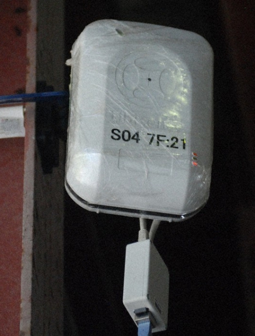
A sensor converts location information into the same signals used in GPS and sends it to drones
There had previously been no other option but for people to operate drones manually inside buildings and other places where GPS signals could not reach. Although there is also a method to operate drones by equipping them with cameras and lasers and have them fly while analyzing images, this method apparently requires slowing down their speed and there are also limitations on the locations they can be flown.
The new drone system was developed in a joint effort by Earth Analyzer, Tokushima University, and i System Research Corp., a tech firm based in Kyoto’s Nakagyo Ward. The GPS used include those of the United States, the Galileo systems of the EU, and Russia’s GLONASS. The seamless drone also uses satellite signals apart from GPS, and the developers are enhancing its precision.
The drone has already entered stages of practical usage, and is apparently scheduled to fly through a water supply tunnel in September after passing through a sluiceway in the Yura River in the city of Fukuchiyama in northern Kyoto Prefecture.
Hisanori Araki, president of Earth Analyzer emphasized the quality of the new system, saying,
“Japan’s infrastructure has been showing signs of deterioration, and there is a high potential demand for inspections by drones. Although manual operation requires time for training skilled pilots, the seamless drone can be flown by anyone even if you aren’t a skilled expert.”
Photos: Mainichi/Yasuhiro Okawa
Source: The Mainichi