
AeroVironment, Inc. and Draganfly have announced a teaming agreement for Draganfly’s distribution of AeroVironment’s Quantix Mapper systems to commercial markets worldwide. The agreement also includes the continuation of other contract engineering services provided by Draganfly to AeroVironment.
Under the teaming agreement, AeroVironment will provide Draganfly sales, marketing collateral, and product technical support for the Quantix Mapper system. Draganfly will provide e-commerce, enterprise and direct sales operations, and oversee development of a network of resellers and strategic distribution partners worldwide.
In advance of the approaching agriculture season in the Northern Hemisphere, Draganfly has procured a significant number of Quantix Mapper systems from AeroVironment. Draganfly plans to expand commercial distribution of Quantix Mapper to the Southern Hemisphere over the next year, and to other industries including environmental resource management, oil & gas, construction, insurance, and public safety.
“Quantix Mapper represents the combination of drone operation, high-resolution imaging and geo-tagging into the first ‘drone as an app’ solution that makes data collection as easy as using a tablet computer,” said Rick Pedigo, AeroVironment vice president of sales and business development. “As a leader in the commercial and first responder drone market, Draganfly is uniquely positioned to deliver the value of Quantix Mapper to customers in multiple market segments to help save lives, protect property, increase productivity and enhance safety.”
“Draganfly has been manufacturing and distributing innovative, multi-rotor and fixed wing drones for commercial applications around the world for 22 years. We were truly impressed with the ease of use, performance, and reliability of AeroVironment’s hybrid Quantix Mapper system” said Patrick Imbasciani, Draganfly’s chief operating officer. “Flying 400 acres in less than 45 minutes on one battery is remarkable. Programming flights by simply drawing a shape on a tablet screen map, selecting an altitude, and following a few prompts, is so easy. Built in visual and multispectral sensors and the ability to take off and land almost anywhere, allow this drone to be used for a variety of applications right out of the box. Equally exciting, is the competitive price.”
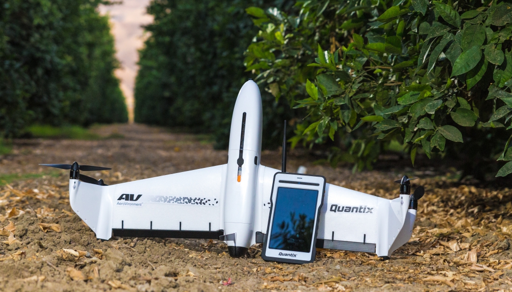
Quantix Mapper is a simple to use drone empowering users through its fully-automated operation and instant insight. Its hybrid design allows the aircraft to launch vertically and transition to horizontal flight, maximizing aerodynamic efficiency and range. Users can immediately view high resolution imagery on the included Operating Tablet – no other devices, internet or additional software required. With the touch of a button, users can quickly and safely generate up-to-date maps for infield assessment. Whether assessing crop health during key stages, or damage from storm, flood or fire, Quantix Mapper makes it easy to gather accurate images across a large area, assess and react to the situation with precision and speed.
Source: Press Release