
Photo: NCDOT
The AirMap team has also been busy with several exciting drone demonstration projects throughout the United States.
AirMap was selected recently as a program partner for both NASA’s TCL4 trials in Texas and Nevada as well as the FAA’s UAS Traffic Management Pilot Program (UPP) at Virginia Tech. In both programs, AirMap is providing a comprehensive, real-time view of the airspace to help manage drone traffic in complex real-world scenarios.
At the same time, work continues on existing demonstration partnerships across the country, where AirMap is partnering closely with regulators, safety organizations and other UAS Service Suppliers (USS) on collaborative activities. The results from these trials will help inform how the U.S. government can best enable safe and scalable drone operations in low-altitude airspace.
NASA TCL4 IN TEXAS AND NEVADA
The National Aeronautics and Space Administration (NASA) is currently undertaking the final phase of a four-part series of technical drone demonstrations, referred to as TCL4. AirMap is partnering with both TCL4 test sites: the Lone Star UAS Center of Excellence & Innovation in Corpus Christi, TX, and the Nevada Institute for Autonomous Systems in Las Vegas, NV.
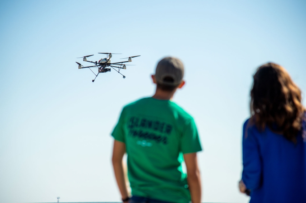
Photo: Texas A&M University Corpus Christi
NASA’s TCL4 trials are designed to test the interaction between drones within UAS traffic management (UTM) systems in a variety of dynamic, higher density urban scenarios for tasks such as news-gathering, package delivery, and managing large-scale contingencies. The AirMap UTM Platform will be providing simulation support for Nevada’s tests planned in June 2019, and then will be supporting live demonstration flights in Texas starting in August 2019.
Currently, the AirMap team is undertaking system tests and simulations alongside other TCL4 partners to prepare for this summer’s tests in each location. At both sites, the AirMap UTM Platform is providing comprehensive digital air traffic intelligence, including flight planning management, telemetry, strategic and tactical deconfliction, and emergency notifications for manned aircraft. Many different USSs will operate someday within the same airspace, and so AirMap is engaged in collaborative network sharing with other USS providers who are part of the trials to ensure interoperability between USS systems. These are all key capabilities needed to enable commercial drone operations on a large scale and under beyond visual line of sight (BVLOS) conditions.
FAA UPP PROGRAM AT VIRGINIA TECH
In Virginia, AirMap has been selected to participate in the FAA’s UPP program at the Virginia Tech Mid Atlantic Aviation Partnership (MAAP). On January 14, 2019, MAAP was designated as one of three FAA UAS Test Sites to partner with the agency under the UPP, which was set up to identify the set of industry and FAA capabilities required to support unmanned air traffic management.
As a member of the Virginia UPP project, AirMap provides a core set of UTM capabilities for flight planning and telemetry, manned aircraft alerts, deconfliction, and network sharing with other USS provider partners. AirMap and other UPP partners are currently in the program integration phase, with live flight tests currently planned for June 2019.
UAS IPP PROGRAM UPDATES
AirMap continues its participation in the national UAS Integration Pilot Program (UAS IPP) set by the White House to accelerate the integration of commercial drone operations into the national airspace. Last year, AirMap was selected to participate in 6 of 10 awards across the country—Choctaw Nation of Oklahoma, Kansas, North Carolina, North Dakota, the City of Reno, and the City of San Diego.
Here is a snapshot of some of the important impacts that drones are already making across the country as part of this program.
North Carolina
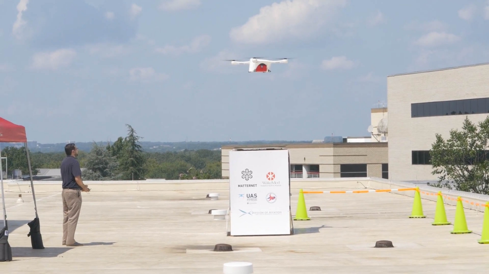
In North Carolina, drone operator Matternet and UPS are using drones to deliver medical samples between WakeMed hospitals in Raleigh. Traditionally, samples are delivered by courier cars subject to road delays. Drones provide an option for time-sensitive medical samples to be delivered faster, improving patient outcomes and hospital operational efficiency. AirMap is providing airspace information and traffic alerts for these flights as well as a UTM dashboard to allow oversight by the North Carolina Department of Transportation, the lead partner in the North Carolina UAS IPP.
These delivery flights build on AirMap’s ongoing operations in Switzerland, where AirMap is integrated into Swiss U-space in partnership with Matternet and the Swiss postal service to similarly power hospital delivery flights. These flights are a compelling example of how drone technology can be used to improve healthcare and are an important step toward unlocking further BVLOS flight capabilities in the near future.
San Diego
As part of the San Diego UAS IPP, the Chula Vista Police Department (CVPD) recently received a Special Provision approval from the FAA to regularly conduct flights beyond the visual line of sight of the operator—the first public safety organization within the IPP to receive such an approval. These BVLOS flights are enabled by drone telepresence and data management company CAPE, with AirMap contributing as the USS provider.
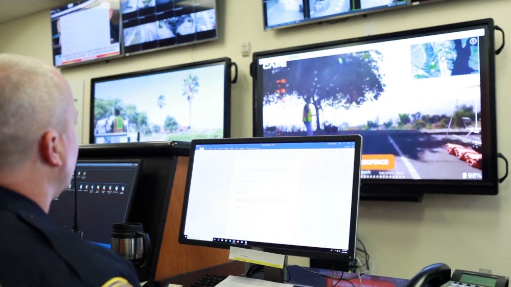
Photo: City of Chula Vista
As part of the trial, the CVPD is responding to 911 calls by dispatching drones to the scene, which allows the police department to make an initial survey, often while the incident is still in progress, and better decide how to approach the situation even before officers arrive on site. The provision expands the zone in which the drones can operate under BVLOS to three nautical miles, allowing the police department to respond to incoming calls from a wider area with drones. The CVPD uses drones for a variety of purposes, including documenting crime and accident scenes as well as assisting in missing person searches.
The UAS IPP trials will continue through October 2020, so stay tuned for more exciting developments in the coming months.
In each of these examples, the AirMap UTM Platform offers a real-time, dynamic, and comprehensive picture of the airspace to unlock safe, efficient, and scalable drone operations. Through its partner programs, we’re showing that the capabilities of UTM can support an increasingly diverse range of advanced and widespread drone operations, with the goal of ultimately enabling innovative enterprise applications, protecting other aircraft in the air as well as citizens on the ground, and arming authorities with the necessary information to keep the skies safe and secure.
Source: Press Release