
Scientific study of the evolution of the southern end of the San Andreas Fault is of vital importance given the earthquake-prone nature of southern California. Mapping fault zones and land surface changes that resulted from previous earthquakes can deepen the understanding of hazards posed by the fault, including the possibility of future temblors.
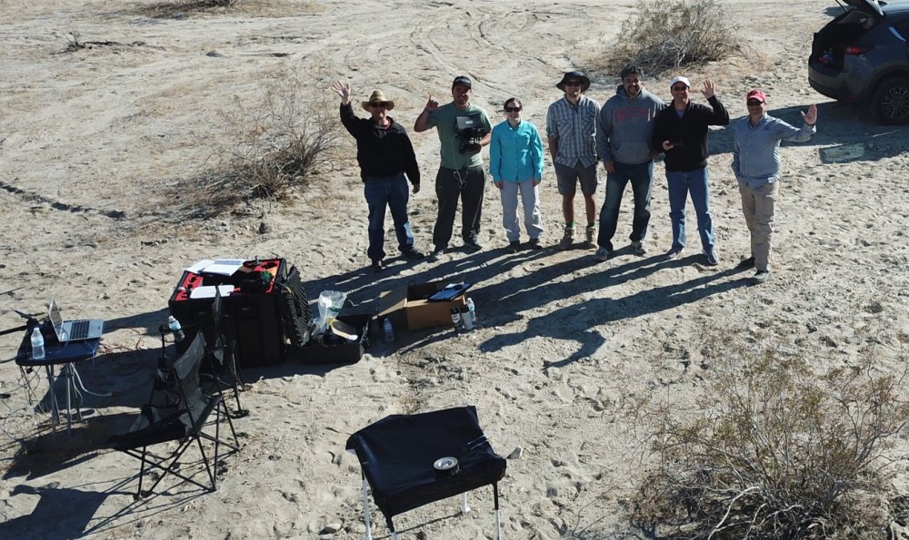
To advance this effort, the Department of Geological Sciences at San Diego State Univ. (SDSU) teamed with Geodetics Inc., a leading manufacturer of integrated mobile mapping systems that utilize passive and active vision sensors (LiDAR/Camera), to research the San Andreas Fault in southern California. The study scanned the fault with Geodetics’ drone-based Geo-MMS™ LiDAR/Camera mapping system that uses Velodyne LiDAR technology and an RGB camera to deliver the most accurate 3D data on the market.
The research is focusing on evaluating both past large slip events (earthquakes) and aseismic creep (also known as “silent earthquakes”), which are tremors that release their energy over weeks or months rather than seconds. It is looking to discover new fault zones and active fault traces, which are visible marks where a geological fault meets the ground surface. The research is also looking to detect fault slip that has resulted from past earthquakes.
“LiDAR mapping represents a very exciting technology for geology since it enables the generation of accurate 3D mapping, even in the vertical component where classical photogrammetry techniques are lacking,” said Dr. Allen Gontz, Professor and Chair of Geological Sciences at San Diego State Univ. “Our researchers at SDSU are planning to continuously monitor the fault to better characterize it and exploit the advantages of the current 3D mapping technique.”
“Being deeply rooted in the LiDAR mobile mapping market, Geodetics is always on the lookout for the best-of-breed sensors for use in our products,” said Dr. Lydia Bock, President and CEO, Geodetics Inc. “We have been working with Velodyne as our LiDAR provider for several years. Velodyne continues to enable Geodetics to meet its goal of offering state-of-the-art systems that are easy to use and offer excellent cost/performance value to our customers.”
“Industry leaders rely on accurate, dependable data created by Velodyne LiDAR technology to provide the highest performing mapping systems in a compact solution,” said Mike Jellen, President and CCO, Velodyne LiDAR. “Geodetics designs and builds advanced mapping systems that make them a go-to provider for precision navigation and sensor integration for mobile applications in the air, on land and sea.”
San Andreas Fault Research
In their study, SDSU researchers are developing a comparison between several techniques for evaluating past slip events and looking to establish precision and accuracy of the techniques relative to each other.
Previous work in this area has utilized traditional photogrammetry techniques using small drones to build digital terrain models of earthquake faults. The Structure from Motion (SfM) approach in photogrammetry to monitor topography changes has been a hot topic in geology for the past two years. However, SfM does not have inherent referencing scale – the scale at which symbols and labels appear on a map at their intended, true size. Other techniques involve LiDAR with the U.S. Geological Service using airborne LiDAR while other researchers have tapped ground-based LiDAR to map topographic expression of the fault and examine offsets, which are the distance the fault is out of line with the map.
The SDSU team used a Geodetics Geo-MMS system including the mapping payload and DJI Matrice M600 Pro drone for its San Andreas Fault mapping. The Geo-MMS payload was equipped with Geodetics’ Point&Pixel technology (the Point (provided by the LiDAR) and Pixel (provided by the camera)) which enabled researchers to generate 3D models without the use of ground control points (GCP), which are marked points on the ground that have known geographic locations.
“Traditional techniques including topographic surveying tools require ground control points in the surveyed area, which are challenging in remote, high alpine environments and fault areas. LiDAR topographic surveying operating on unmanned aerial vehicles takes mapping to a new level because of its coverage scale and high resolution without the need of ground control points,” said Dr. Bock.
Geodetics Expands Product Portfolio
Geo-MMS, which currently uses several Velodyne LiDAR sensors including the Velodyne PUCK™ VLP-16 sensor, delivers accurate georeferenced LiDAR point clouds to customers in agriculture, construction, forestry, infrastructure, mining and urban planning. Since Geodetics develops all electrical, mechanical, algorithm design and software components used in its products, the company is in a unique position in the LiDAR drone mapping space to innovate quickly to deliver new state-of-the-art technologies.
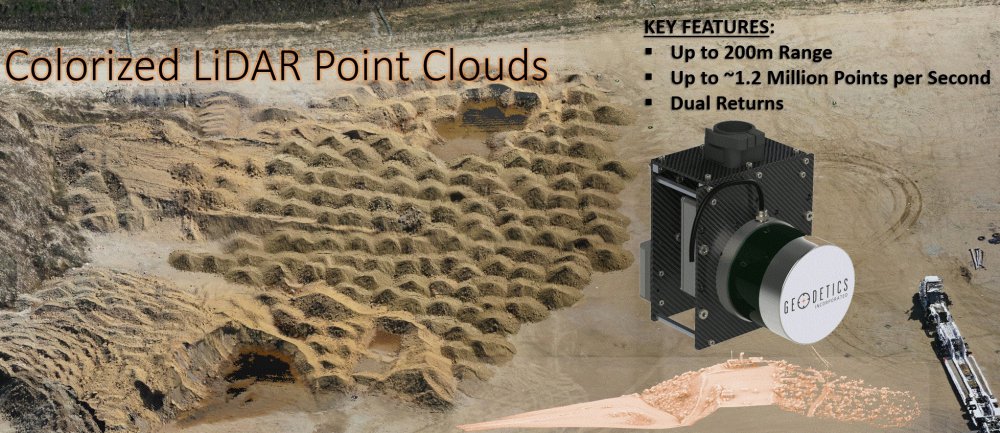
Geodetics is deepening its relationship with Velodyne by expanding its Geo-MMS product offering with integration with the Velodyne’s ULTRA Puck VLP-32C. The VLP-32C is a long-range LiDAR sensor that combines best-in-class performance with a small form factor. It is a high-resolution LiDAR sensor that is cost effective compared to similar performance sensors and retains innovative breakthroughs such as 360° surround view along with real-time 3D data that includes distance and calibrated reflectivity measurements along with rotational angles.
Geodetics is also introducing the innovative Point&Pixel capability to its Geo-MMS product offerings, advancing its strategy to provide industry professionals with cost-effective, streamlined solutions to produce 3D georeferenced point clouds. Point&Pixel enables accurate colorization of the LiDAR point cloud using synchronously captured RGB images from a camera during the same flight as the LiDAR scanning collection. The industry-leading Geodetics approach allows users to create colorized point clouds and photomosaic quickly without requiring multiple overflights of an area or different scan patterns. Point&Pixel is expected to be available in the third quarter of 2018.
Additionally, Geodetics is introducing its new Geo-Photomap product for applications such as vertical mapping and corridor mapping. Geo-Photomap enables accurate automated 3D mapping using direct-georeferenced images (geo-tagged images) – images associated with a geographic location. With Geo-Photomap, high-accuracy positioning and external orientation angles are generated, eliminating the need for ground control points and reducing image overlap to as low as 30 percent resulting in significant cost savings.
“Our team of scientists and engineers enables Geodetics to be much more than a system integrator. We design and build the technologies in our LiDAR mapping systems and are poised to move the state-of-the-art in LiDAR mobile mapping for geological research and much more to the next level,” said Dr. Bock.
Source: Press Release