
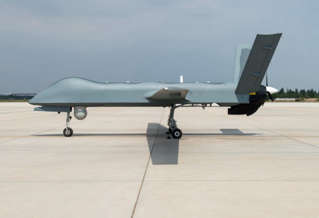
 A CH-4 unmanned aerial vehicle (UAV), also known as a “rainbow drone,” will officially enter service to monitor forest fires in northeast China, following a deal inked between the regional forestry authority and the drone’s manufacturer in Beijing on Nov. 19, 2017.
The drone’s deployment will enhance fire monitoring in China’s Greater Khingan Mountainous, a task formerly undertaken by forest keepers’ visual observation from fixed look-out posts and, occasionally, from manned aircraft.
Although effective, such methods were far from efficient, relying on a lot of manpower and their shortcomings are apparent, said Wang Hongbin, deputy chief of the Greater Khingan Forestry Authority, at the contract signing ceremony.
“For example, human eyes cannot see through fog in case there is a fire, and our [manned] aircraft aren’t cleared for nighttime aviation,” he said.
By contrast, the CH-4 is equipped with both visual and infrared sensors to allow it to see day and night and, more importantly, through fog.
In particular, the CH-4 is installed with near-infrared sensors that allow it to see through dense smoke and pinpoint the source of a fire.
“This is something human eyes can never achieve, no matter how many lookout posts are set up or how many manned planes are put in the air,” said Zhou Nai’en, deputy general manager of CH UAV Company, which is affiliated to the China Academy of Aerospace Aerodynamics (CAAA).
Zhou said that traditional aerial observation for forest fire was conducted by people looking out through the plane’s portholes with binoculars. “Flying too low risks safety but flying too high reduces efficiency,” he said, inferring that an all-weather, high endurance drone was the right solution.
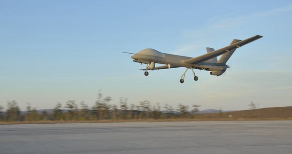
Public data show that in normal operations, a CH-4 can stay airborne for more than 30 hours at an altitude of 4,000-5,000 meters. In other words, one sortie can provide constant aerial surveillance for almost two days during which the drone’s ground staff can take a rest in shifts.
The burden is eased for ground staff in that the pilots are only responsible for the flight while the task of detecting fires is left to the various sensors in the drone’s payload.
The drone’s deployment followed pressing demands from local forestry authorities for a “scientific and technological innovation” in forest monitoring and early warning of fire, said Wu Pengchao, chief of the Tahe Aviation Station, the future homeport for the CH-4.
Wu said that the State Forestry Administration allocated a special fund for such innovations and the local Forestry Authority considered that a rainbow drone would “ideally answer the demand” in terms of being affordable with a superb performance.
Forest surveillance in the Greater Khingan Mountains, which are situated between 50 to 53 degrees north latitude, is the northernmost mission so far for a rainbow drone. The location means the drone is farther from geosynchronous satellites, which are stationed above the equator.
“Hence, after preliminary tests in May we did special modifications as to increase its capacity for satellite communication to ensure the data link doesn’t break during flights,” said Zhou, “and of course, in the actual drone to be delivered, we will disable the fire control module.”
Forest surveillance in northeast China is the latest mission to add to the list of civil tasks conducted by drones in the rainbow series, which has gained fame in overseas anti-terrorism operations. CH-4 alone is a star UAV that has been exported to 10 countries.
Civil or military agencies in those countries are interested in rainbow UAVs’ capability in aerial surveillance, geological exploration, regional communication restoration and fire control.
Zhou, a designer for rainbow series drones, maintained that a UAV was a neutral, basic platform whose payloads are what decide whether its mission is civil or military. Forest fire monitoring services is another example of the widely called for military-civil integration.
Source: China.org