
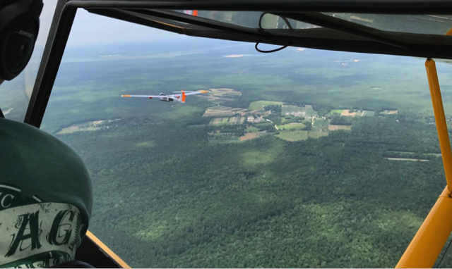
Chase plane view of following unmanned aircraft system
In mock drill, UAS with first-of-its-kind “flying cell site” delivers wireless service to first responders in a “communications-denied” environment.
At this time of year, tropical storms with wind speeds of up to 100 mph or more can strike the Eastern seaboard of the United States with destructive force. Tasked with dealing with the devastation such hurricanes can inflict, emergency management officials are ever on watch for new and better ways of communicating and providing community support in the aftermath of such a disaster.
On June 20, Cape May County, N.J., Verizon and American Aerospace Technologies, Inc. (AATI), took the next step in advancing cutting-edge communications for disaster response in coastal New Jersey. First responders used smartphones to connect to a first-of-its-kind “flying cell site,” which was mounted on the wing of the RS-20 long-endurance UAS and made calls, sent text messages, photos and video from a simulated “communications-denied” environment back to command centers across the state.
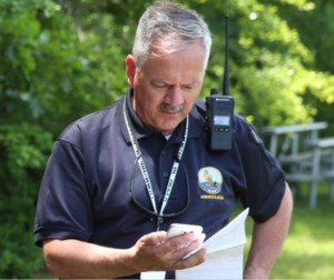
1st responder with smartphone
The wireless coverage was provided by Verizon’s Airborne LTE service aboard AATI’s long-endurance unmanned aircraft system (UAS). The exercise was directed by the Cape May County Office of Emergency Management with exercise participants including first responders from Cape May County, New Jersey State Police and the U.S. Coast Guard in a scenario designed as response to a category II hurricane.
The flying cell site is intended to provide wireless voice and data communications capabilities to areas where communications have been interrupted due to storm damage. Additional imaging and sensor equipment, meanwhile, can relay pictures and other sensor data in near real-time to first responders seeking information about post-storm conditions on the ground by utilizing backhaul from Verizon’s Airborne LTE service.
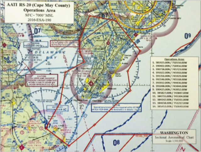
The craft operated under a Certificate of Authorization (COA), issued by the Federal Aviation Administration, which regulates all aspects of civil aviation. The COA was issued to Cape May County for an 800-square mile area to 7,000 feet to conduct missions that will serve public purposes such as emergency response. Unlike the “Part 107 Rules” issued by the FAA in 2016 that allow aircraft under 55 pounds to fly below 400 feet in close proximity to the pilot, COAs allow aircraft to operate at far greater distances and at much higher altitudes. For example, the RS-20 UAS used in this exercise weighs 175 pounds and flies many miles down range.
The AATI aircraft is piloted by an on-ground crew that controls the fixed-wing aircraft from a mobile operations center. The mobile operations center is the land-based cockpit for the pilot as well as engineering and payload specialists who guide and monitor the aircraft’s activity beyond their line of sight using radios linked to the aircrafts avionics and autopilot. Under the current COA, the exercise required a chase plane although the ultimate goal is to operate the UA independently beyond line of site.
“To our knowledge, this is the first time that first responders in the U.S. have exercised the game-changing capabilities that a flying cell site and near real-time imaging systems can provide after disaster strikes,” said David Yoel, CEO and founder of American Aerospace, and an advisor to Cape May County on aviation matters. “These are capabilities that can greatly benefit first responders not only here, but across the U.S.”
The unique nature of the COA may enable the county to obtain authorization for post-disaster use of unmanned aircraft to assist other local government agencies in need elsewhere along the eastern seaboard of the U.S., in appropriate circumstances.
“New FAA regulations, coupled with advances in wireless communications, sensor technology, cloud services and airborne enterprise systems, have created a perfect storm for innovative new services and capabilities that, I believe, will propel UAS technology development in much the same way that the personal computer and the Internet drove innovation in the digital age,” said Yoel.
Cape May County is located on the southern tip of New Jersey, jutting out into the Atlantic Ocean and a prime target for tropical storms. It also is located centrally in the New York-Washington corridor and a short distance from Philadelphia — hence, a popular summer playground destination for tens of millions of Americans who come to play on miles of sandy barrier island beaches abutted by a string of quaint Victorian-style seaside villages.
“We are strong believers that drone technology will serve many important public purposes. We are especially delighted to support development of any tools that will assist our first responder community,”
said Cape May County Freeholder Will Morey, a licensed pilot, seaside resort operator and supporter of the county’s drive to develop a center of innovation for unmanned airborne vehicles and systems startups.

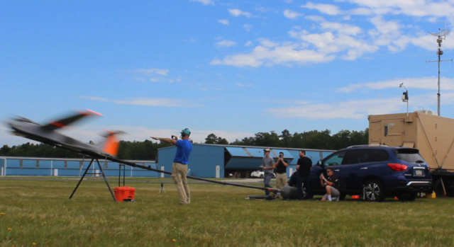
During the June 20 exercise, emergency personnel — county officials, state and park police, and other first responders were invited to a remote woodland preserve for campers in a simulated “coverage-denied environment” where Verizon engineered a bubble of limited wireless service. The UAS was launched from a municipal airport five miles away to orbit the forest.
Once the “flying cell site” arrived and began its circumnavigation of the parkland, first responders were able to connect to the Verizon network through the wireless technology inside the drone, and communicate back to the Cape May Emergency Operations Center in Cape May Courthouse (13 miles away) and the New Jersey State Police command center in Trenton (90 miles away) via the Verizon network using Samsung smartphones adapted for the test. They made calls, sent texts and emails, uploaded photos, sent videos and accessed social media applications on the smartphones.
“This exercise proved that this ‘flying cell site technology’ works in a real-world environment using smartphones off the shelf. In fact, we registered connections on Verizon customer devices beyond the phones we provided to first responders,” said Christopher Desmond, Principal Engineer, Verizon Network. “Data gathered from today’s successful flight will be used as we continue to optimize the ‘pocket of coverage area’ we can provide from an aircraft for disaster use in the future.”