
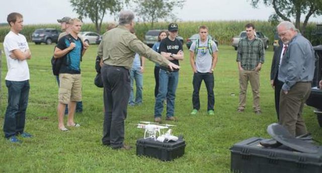
 Cedarville geology and geoscience students are working on two senior projects using an Unmanned Aerial System (UAS), , as part of a partnership with Remote Intelligence, LLC., in Wellsboro, Pa. Remote Intelligence is partnering with Cedarville to provide guidance and material resources to students. Cedarville and Remote Intelligence are also in preliminary talks to study how UAS systems could help in the planning, construction, and monitoring of natural gas pipelines.
“Typically, nowadays, when a remote site needs to be assessed, it can require many days and great cost for a ground crew to do the field work to gather a limited amount of data,” said Thomas Rice, assistant professor of geology. “With a UAS, the same field work can be done at much-reduced safety risks, at lower costs, with faster turnaround of information, and with greater quantity and quality of data.”
One of the students working on a senior project, is Ryan Gustafson, is researching the causes of long-term standing water and a remediation of the storm water runoff along Cedarville University’s cross country course which is located east of Route 72 in Cedarville.
“I’ve run track and cross country for four years, and I’ve noticed all the times that I’ve run here that there’s one specific spot on the cross country course that always has a lot of standing water after it rains,” Gustafson, a geology major from Fox River Grove, Ill., said. “That makes for poor race conditions and poor race time.”
Gustafson will use information from drone flights and geological research of the cross country field to figure out the frequency of the standing water and whether subsurface conditions contribute to the problem. He may make recommendations to the school on measures that can be taken to help fix the problem long term.
Samuel Rice, a geoscience major from Wellsboro, is also working on a senior project. Rice’s work continues a project he started two years ago in an environmental geology class. He measured the depth and volume of Cedar Lake in his class two years ago, and he measured it again this year using measurements taken by environmental geology students as well as drone images. Rice wants to see if there have been any changes in lake depth over the last two years. He will use the data to create maps of the depths of the lake.
“I figured it would prepare me for the work world,” Rice said. “For example, a natural gas drilling operation may need to assess the amount of water in a nearby lake in order to use it.”
Source: Xenia Gazette