
 Mapping the trees in Finland’s forests sounds like a Herculean task – there are 30 billion of them, making it Europe’s most densely wooded nation. But for one start-up that’s just the warm-up act to its plan to use laser-equipped drones to shake up industry at large. From package deliveries to nuclear power plant examinations, the Helsinki-based Sharper Shape can see limitless possibilities for its system.
But first there are the woodlands. About 70% of Finland is covered in trees. Sharper Shape intends to use drones to map Finland’s forests. That’s a boon for the country’s pulp, paper, furniture and tourism industries – but a headache for the electricity companies that serve them.
For years the utility firms have had to conduct extensive land surveys to ascertain where to lay power lines as efficiently as possible.It has involved using helicopters to collect data, which is then analysed by a team of workers – an expensive and time-consuming process.
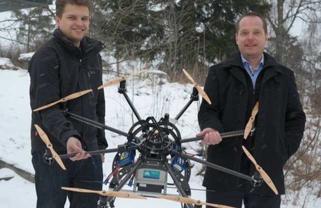
Tero Heinonen founded Sharper Shape 11 months ago to cut costs by doing the work with UAVs (unmanned aerial vehicles). “The name of our company – Sharper Shape – comes from the technical capability to re-create the environment in a digital form,” Mr Heinonen tells the BBC. “We create a model that is sharper than the reality.”
Point clouds
The firm uses an Octocopter fitted with eight rotors and a Lidar (light detection and ranging) laser. This sensor – already used by road-mapping companies – scans the extensive network of power line corridors through a forest. The data is processed and transformed into billions of 3D points, known as a “point cloud”, that represent the external surfaces of the scanned objects.

“We create a model within a centimetre accuracy of all of the components of power transmission – poles, pylons, isolators,” Mr Heinonen says.”But we also create a model of each individual tree, which enables us to understand the clearance distances.”
The data is also used to model the vegetation’s growth, allowing the company to predict risks such as when a tree might fall onto the power cables. Mr Heinonen suggests that his firm’s UAVs could reduce utility company costs by up to 50%. And because the system is fully automated he adds that data analysis that would normally take five months to complete can be done by a machine in a week.
Safety and privacyThe potential hitch is that the tech has yet to be approved by Finland’s aviation regulator, Trafi. For now the company is working round this by applying for special flying permits for human-operated remote-controlled tests to be carried out in September, in which the UAS remain in their operators’ line of sight 100m (330ft) above the ground.

“Trafi’s primary concern is safety and security,” Mr Heinonen says. “But they fully realise that there is a new paradigm in aviation that is coming. They are taking steps to prepare for UAS.”

High ambitions
Sharper Shape is a small team of less than 10 people, but it has big ambitions. Mr Heinonen says he is in talks with two of the largest geospatial and mapping companies in the world – the Dutch Fugro and Japanese Pasco.
There is also the possibility of a tie-up with Amazon, the world’s largest online retailer. Last December the US firm revealed plans to use drones to deliver packages weighing up to 2.3kg (5l.1b) to customers within 30 minutes of them placing the order – although chief executive Jeff Bezos added that it might take five years for such a service to launch. Mr Heinonen says he has been in talks with Amazon about Sharper Shape’s technology but adds: “I can’t say anything else.”
For now, the Finnish entrepreneur estimates that 95% of UAV use is for defence and law enforcement purposes. But regardless of his own firm’s fortunes, he says it is inevitable that drones will transform commerce, ultimately becoming as common a sight as delivery vans.

“There will be tens of thousands of them in airspace doing engineering inspection surveys and Amazon-style deliveries,” he suggests. “They will become an everyday object that are taken for granted. The future is going to be very different for us all.”
Source: BBC