
 Limited landing area as well as interference due to wind disturbance and wave motion make shipboard landings of unmanned aerial vehicles (UAVs) extremely difficult. Use of UAVs at sea can enhance the efficiency of intelligence gathering and surveillance, and could also increase long-range air-strike capability. To successfully land aircraft in such a challenging environment requires a high-precision navigation system; this prototype applies RTK measurements.
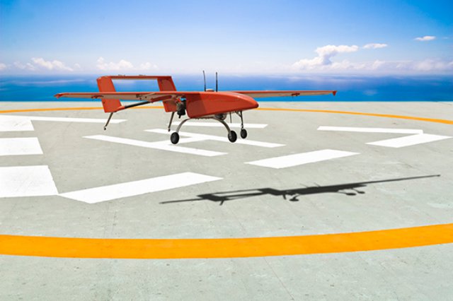
UAVs can perform functions such as surveying, imaging, detection, sensor work, rescue, and geographic information systems (GIS) data collection. The exploitation of UAVs with portable launching and recovery systems using an automatic guidance equipment can enhance their flexibility in many practical applications. In particular, UAVs can achieve great effectiveness from launch and recovery aboard ships at sea. However, the landing area is narrow on a ship, and interference related to the maritime environment due to wind disturbance and wave motions varies greatly, making maritime UAV landings quite difficult. Recovering these aircraft in such a rapid-dynamic environment requires a high-precision UAV navigation system.
Generally, UAVs use a differential GPS (DGPS) aiding station to continuously transmit positioning correction information during landing approach; this method can provide about 0.7 to 1-meter accuracy. However, shipboard landings require more stringent accuracy. According the Joint Precision Approach and Landing System (JPALS), the requirements of shipboard landing include vertical accuracy on the order of 0.3 meters, and the requirement for the vertical protection level is 1.1 meters. To fulfill these accuracy requirements, we have chosen the real-time kinematic (RTK) technique. Recently, researchers have studied the use of RTK satellite navigation. The Boeing Unmanned Little Bird program has been examining shipboard launch and recovery using related navigation techniques.
The accuracy of using RTK navigation is 1 centimeter + 1 part per million.
Since development of shipboard landing is costly in terms of time and many resources, including human resources, this research is an attempt to evolve a software-in-the-loop (SIL) simulation system to analyze the accuracy of using RTK for landing navigation. The SIL system uses the MATLAB Simulink interface becasue of its helpfulgraphic user interface and block diagrams. A flowchart of the SIL system is shown in Figure 1.
The simulated RTK message provides the navigational data used as the analysis results from the experiments. To ensure the stability of the landing process, the aircraft models were control by a linear quadratic Gaussian regulator (LQG), which is able to reject the environmental disturbances encountered in the landing process. The ship motions were simulated using the factors and the model formulated by the International Towing Tank Conference. A combined position error consisting of the aircraft controls and ship motions was calculated and then fed back to the RTK navigation message.
RTK Performance
RTK navigation provides high positioning performance in the range of a few centimeters; the technique can eliminate main errors, including ionospheric and tropospheric errors and satellite clock errors, among others. A base station and a rover station can cover a service area of about 10 to 20 square kilometers. The data transition should be in real time using a wireless VHF or Wi-Fi modem.
Because data for shipboard landings are difficult to acquire, the navigation message in the SIL was simulated using experiments involving a variety of conditions. In this article, four kinds of experiments were included to help verify the availability and reliability of using RTK information as a navigational message.
Conclusions
Experimental results showed that 99 percent of the horizontal positioning was in the range requirement of 0.3 meters. Using the common view satellite experiment and the sea state variation experiment conducted in this study, the limitations of RTK positioning can be understood. Monitoring the RTK status can provide high-quality accuracy with regard to guidance of the landing process. We hope that the results of this study will become a reference for building a shipboard landing system in Taiwan.
By Chiu-Jung Huang and Shau-Shiun Jan
Chiu-Jung Huang received her B.S. degree from National Cheng Kung University (NCKU) in Taiwan. She is currently studying for her M.S. degree in aeronautics and astronautics at NCKU.
Shau-Shiun Jan is an associate professor of aeronautics and astronautics at NCKU. He directs the NCKU Communication and Navigation Systems Laboratory (CNSL). His research focuses on GNSS augmentation system design, analysis, and application. He received his Ph.D. degree in aeronautics and astronautics from Stanford University.
To read the complete study, click here.
Source: GPS World