
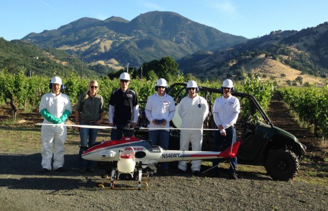
 Yamaha Motor Corp., U.S.A. announced the inaugural commercial operation of its RMAX remotely piloted helicopter for agriculture spraying service in the U.S. The RMAX flight was completed this week in California for Napa-based Silverado Farming Company, a leading vineyard management company.
Online Quoting Platform for Commercial UAV Insurance
![]()
Skyvuze Technologies, an agency providing Unmanned Aerial Vehicle (UAV) insurance, is working alongside organizations on the cutting edge of a new online quoting platform that is scheduled to be launched over the next couple months.
Civil Aviation Authority of Fiji Issues Warning

Remotely piloted aircraft systems, more commonly known as drones, need to be registered with the Civil Aviation Authority of Fiji before being flown. Continue reading
US Government Issues Privacy Best Practices for UAS
![]() The National Telecommunications & Information Administration released Thursday a list of voluntary privacy best practices for commercial and non-commercial drone users, in the wake of concerns that drones could encroach on individual privacy and open a new front in the collection of personal data for commercial use.
The National Telecommunications & Information Administration released Thursday a list of voluntary privacy best practices for commercial and non-commercial drone users, in the wake of concerns that drones could encroach on individual privacy and open a new front in the collection of personal data for commercial use.
Russian Helicopters Show New UAS at HeliRussia-2016
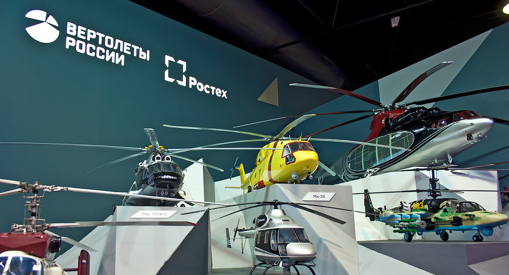 The Russian Helicopters manufacturer unveiled its three new unmanned aerial vehicles, including an upgraded tiltrotor, a multirotor and a helicopter at the HeliRussia-2016 international helicopter industry exhibition.
Hermes 450 Inaugural Flight in North Dakota Ag Project
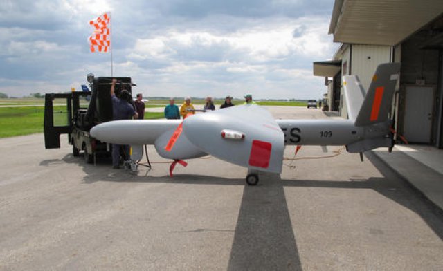 The Elbit Systems Hermes 450 aircraft took off from the Hillsboro airport on May 20th. to start a summer-long project that will take pictures of farmland in the fertile Red River Valley. The test is meant to show whether the larger drone is more efficient to capture imagery of agricultural land than satellites or smaller unmanned aircraft.
Advanced Image Processing Software for UAS
Icaros Inc., a provider of aerial remote sensing services and software, has announced that Harris Geospatial Solutions, a division of Harris Corporation, will offer the Icaros OneButton family of image processing software as a front-end complement to its ENVI geospatial analytics solution for users extracting information from manned and unmanned aerial sensor data. Continue reading
Binocular Vision System for Autonomous UAV Refuelling
A binocular vision-based platform has simulated autonomous aerial refuelling (AAR) between two unmanned aerial vehicles (UAVs) in real time, using a boom approach. The platform may be the first step toward a vision-based sensor and navigation system that could enable in-air refuelling of UAVs without pilot assistance. Continue reading