
Unmanned aerial vehicles (UAVs) could fly deep into the heart of a raging wildfire, avoiding sudden flare-ups and dodging falling tree branches to gather critical information for rescuers. But in this dangerous situation, the UAV could easily be damaged or destroyed by falling debris.
The UAV — and the rescuers who rely on it — would benefit from a new, autonomous navigation system that is guaranteed to avoid collisions, even in completely unfamiliar surroundings.
Developed by MIT researchers, this method plans a flight path for a UAV that eludes unknown obstacles that may move in unpredictable ways. It charts an efficient course through an unmapped environment that is mathematically proven to be safe from collisions. Many popular navigation systems can only offer formal safety guarantees when the environment is static, or when the obstacles are known in advance.
By enabling the UAV to avoid moving obstacles while it is discovering its environment, this trajectory planner, which the researchers call “SANDO” (for “Safe AutoNomous trajectory planning for Dynamic unknOwn environments”) could be especially useful for applications like search and rescue missions into collapsed buildings, mine explorations through networks of hidden tunnels, or package delivery across a crowded neighbourhood.
“In the hardest possible environment, where the UAV has no map of the area and there are unknown obstacles moving around, we established a mathematical guarantee of safety. The only thing the planner needs to know is the top speed the obstacles could reach. Given that, you could use it in any environment, without a map, and you know the UAV is not going to crash into anything,”
says Kota Kondo SM ’23, PhD ’26, who recently earned his doctorate in aeronautics and astronautics at MIT and is lead author of a paper on this new system.
He is joined on the paper by Jesús Tordesillas PhD ’22, an assistant professor at Comillas Pontifical University in Madrid; MIT graduate students Juan Rached, Lili Sun, and Yixuan Jia; and senior author Jonathan P. How, a Ford Professor of Aeronautics and Astronautics and a principal investigator in the Laboratory for Information and Decision Systems (LIDS) and the Aerospace Controls Laboratory (ACL) at MIT. The research appears in the IEEE Transactions on Robotics.
Safety First
Trajectory planners use images and data from a UAV’s onboard cameras and sensors to chart a flight path that reaches the vehicle’s goal. Most existing planners are either designed for unknown static environments, where the obstacles don’t move, or they loosely avoid dynamic obstacles without providing a formal guarantee that the robot won’t crash.
Formal safety guarantees are important in high-stakes situations, such as if a UAV were delivering medical supplies to the site of a remote natural disaster. But trying to compute every possible crash in a dynamic environment would take too long for real-world deployments.
SANDO starts by mapping out a safety corridor through the robot’s environment. This corridor is a series of connected regions of 3D space the robot can travel through, which are guaranteed not to contain any obstacles. While the system doesn’t know exactly where an obstacle will move in the future, it uses that obstacle’s maximum velocity to compute how far it could possibly go in a certain timespan. It puts a sphere around the obstacle that captures the farthest distance it could travel in all directions.
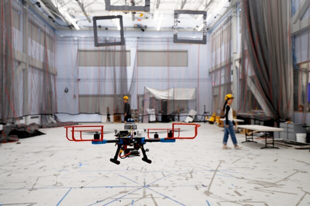
SANDO builds the safety corridor around these spheres to ensure the UAV will not collide with a moving object. It also avoided all dynamic obstacles in 12 test flights with a real UAV, using the robot’s onboard computer and sensors to rapidly replan safe trajectories.
This research is funded, in part, by the Defense Science and Technology Agency of Singapore.
Read the full article in UAS NEWS | PRO
Source: MIT News