
To counter increasingly pervasive jamming of GPS signals, the Pentagon’s Defense Innovation Unit (DIU) is launching a programme to mature magnetic navigation, or “magnav,” systems.
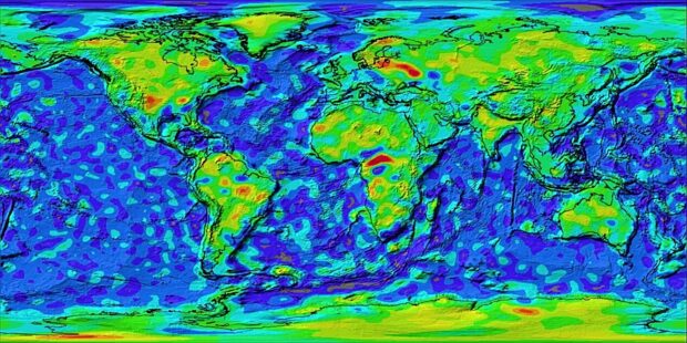
Magnav relies on magnetometers—highly sensitive instruments that detect variations in the Earth’s magnetic field caused by magnetic rocks in the outer crust. According to a new DIU solicitation, the technology offers the promise of “resilient, unjammable navigation,” particularly over oceans. Unlike satellite-based systems such as GPS or China’s Beidou, magnav is passive and does not emit radio frequency signals that adversaries can detect or attack.
While magnetometer technology itself is well understood and widely used in geophysical research, magnav has not been adopted broadly for navigation because of a lack of accurate, high-resolution geomagnetic reference maps tied to precise coordinates. This shortfall is especially acute over open oceans, where most existing magnetic surveys are sparse.
DIU notes that current commercial airborne platforms used for geological surveys are optimized for land and lack the range to collect data over vast ocean areas. Addressing this gap will require modifying existing platforms for over-water operations while significantly reducing costs through scalable techniques. In some regions, DIU adds, attritable and lower-cost aircraft may be necessary due to the likelihood of loss.
Under its new Geomagnetic Airborne Unmanned Survey System (GAUSS) program, DIU is seeking industry prototypes for magnetic data-collection platforms that support precision navigation beyond GPS. GAUSS is envisioned as a multi-year, multi-phase effort to demonstrate mature magnetic mapping technologies capable of enabling magnav across transoceanic distances. Budget and schedule details were not disclosed.
DIU expects to fund multiple aircraft types, citing examples ranging from high-altitude platforms flying around 30,000 feet to low-altitude systems operating near 2,000 feet above the ocean surface. The agency is also interested in novel methods to correct for day–night magnetic field fluctuations, including space-weather data and loitering monitoring assets.
Industry responses are due by Jan. 22.
The full solicitation can be accessed here.
Photo: A model of the magnetization of the Earth’s crust, based on measurements made by NASA satellites Magsat, OGO-2, OGO-4, and OGO-6. Warm colors (reds) indicate the strongest magnetizations while cool colors (blues) the weakest. (Image: NASA)
Sources: DIU; Breaking Defense