
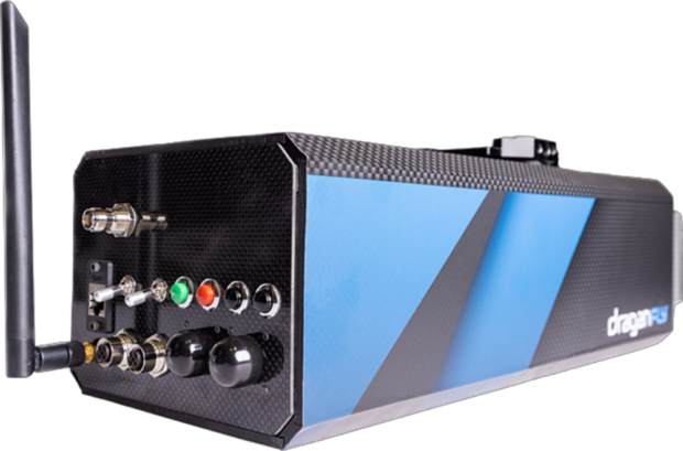
Draganfly Inc. has announced the launch of its new North American-made Long Range Light Detection and Ranging (“LiDAR”) system.
Draganfly’s Long Range LiDAR system is able to provide accurate distance measurements and improved resolution over conventional photogrammetry methods. With a scanning range of 750 meters, the Company’s system is able to produce 0.5-centimeter point cloud precision with two-centimeter global accuracy, which ensures high-resolution data at two million points per second.
Draganfly’s Long-Range LiDAR system is compatible with unmanned aerial vehicles (“UAVs”), helicopters, and other aircraft. It can also be used as a mobile scanning solution when mounted on a vehicle or backpack.
The Company’s cutting-edge sensor technology can be used for multiple applications, including mapping and surveying forests, cities, real estate, energy infrastructure, and telecommunications infrastructure, to name but a few customer-driven use cases.
According to a recent report by Fortune Business Insights, the global LiDAR drone market is projected to reach $455 million USD in 2028 with a compound annual growth rate (“CAGR”) of nearly 18%. The advancement of dynamic sensor technologies continues to broaden the product range and is making UAV-based LiDAR more appealing across a variety of major markets.
“For years, Draganfly has developed versatile, cutting-edge sensor technology that ensures precision and accuracy. Whether it is utilized by air or on the ground, our Long Range LiDAR system is able to safely and effectively provide industry leaders with the mapping data they require,”
said Cameron Chell, President and CEO of Draganfly.
Source: Press Release