
Crash scenes are hectic, dangerous for first responders and motorists, and can lead to extended delays as traffic comes to a standstill or is rerouted. However, crash scenes are also crime scenes that require securing and collecting evidence for legal and insurance purposes.
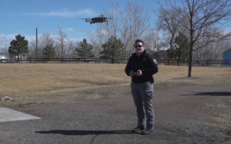
Last year, the Colorado State Patrol investigated 3,511 fatal and injury crashes. This year, dozens of troopers across the State are becoming certified operators of small unmanned aircraft systems (sUAS), commonly known as drones, and turning hours into minutes for crash scene reconstruction at most of our large-scale incidents.
“Over the years, we’ve moved from pencils and tape measures to robotic total stations, and that brought our time down from 8 hours to 2-3 hours while reconstructing a scene,” stated Captain Aulston, Colorado State Patrol. “By using this technology, we can complete our investigations even quicker and with greater accuracy. Oftentimes, we can complete the mapping step of the investigation in 10 minutes or less.”
Anything that speeds up the collection of evidence saves lives. According to the U.S. Department of Transportation’s Federal Highway Administration, the likelihood of a secondary crash increases by 2.8% for each minute the primary incident continues to be a hazard, increasing the risk to driver and responder lives, and making it even more difficult for responders to get to and from the scene.
By significantly speeding up data collection for crash scene reconstruction, drones are helping investigators clear roads much quicker after an accident, and thereby helping to reduce the potential for secondary crashes. In addition, the use of unmanned aerial vehicle technology allows troopers to complete an investigation without subjecting themselves to standing within the roadway or, at the very least, greatly reduce the time they are standing within the roadway placing themselves at risk for a struck-by incident.
Not only is the technology faster than traditional ground-based measurements, but drone mapping provides more comprehensive documentation. Compared to traditional recording tools, aerial photos reveal much more about crash scenes, including topography. Hundreds of high-resolution images recorded by drones help reconstruct accident scenes. After the visual data collected at the scene is uploaded into mapping software, it is processed into 3D models of the scene via photogrammetry.
“While Coloradans will rarely see them in action, we are aiming for motorists to experience less disruption on our roadways,” stated Captain Aulston. “It’s great to use this new tool that speeds up the process while also helping everyone get where they need to be, safe and sound.”
The Colorado State Patrol sUAS Program is designed for limited use including crash scene reconstruction and traffic incident management.
Source: Press Release