
Known in Switzerland as SBB, the Swiss Federal Railways system provides the highest quality national public transit service in Europe according to the European Railway Performance Index.
In addition to transportation, SBB also oversees energy infrastructure and real estate that supports it, among other projects. Established in 1902, the firm has become a Swiss icon, demonstrating reliability and quality. While its legacy might tempt people to think it’s traditional, it’s very much forward thinking.
“If you ask people, they may think that SBB is an old government company and really not innovation driven,” said Andreas Hoffmann, Project Engineer at SBB’s Center for Drone Competence. “What I’ve learned is that it’s really quite the opposite. I’ve been surprised by how flexible they are, especially in certain areas relying on virtual reality, augmented reality, machine learning, and now drones.”
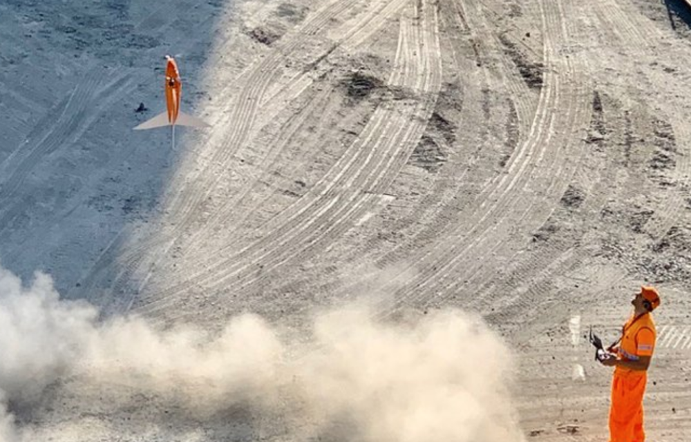
WingtraOne joins a legion of about 80 drones that SBB uses to monitor infrastructure as well as the effects that climate change is having on it.
The Sihlsee is a man-made lake in Canton Schwyz used for energy generation. SBB oversees this infrastructure, including turbines sitting on the lake bed, which generate electricity when snowmelt and rain water flow into it. They started flying WingtraOne over the lake to map the shore and various water levels, because they can not afford it if the lake stays low for too long.
In fact, if the Sihlsee doesn’t fill to a certain level by the end of May, SBB must pay penalties. In some cases, they must pump water from Lake Zurich to restore the Sihlsee levels. These cases are becoming more frequent with the climate reducing the snowfall and melt, as well as rainfall.
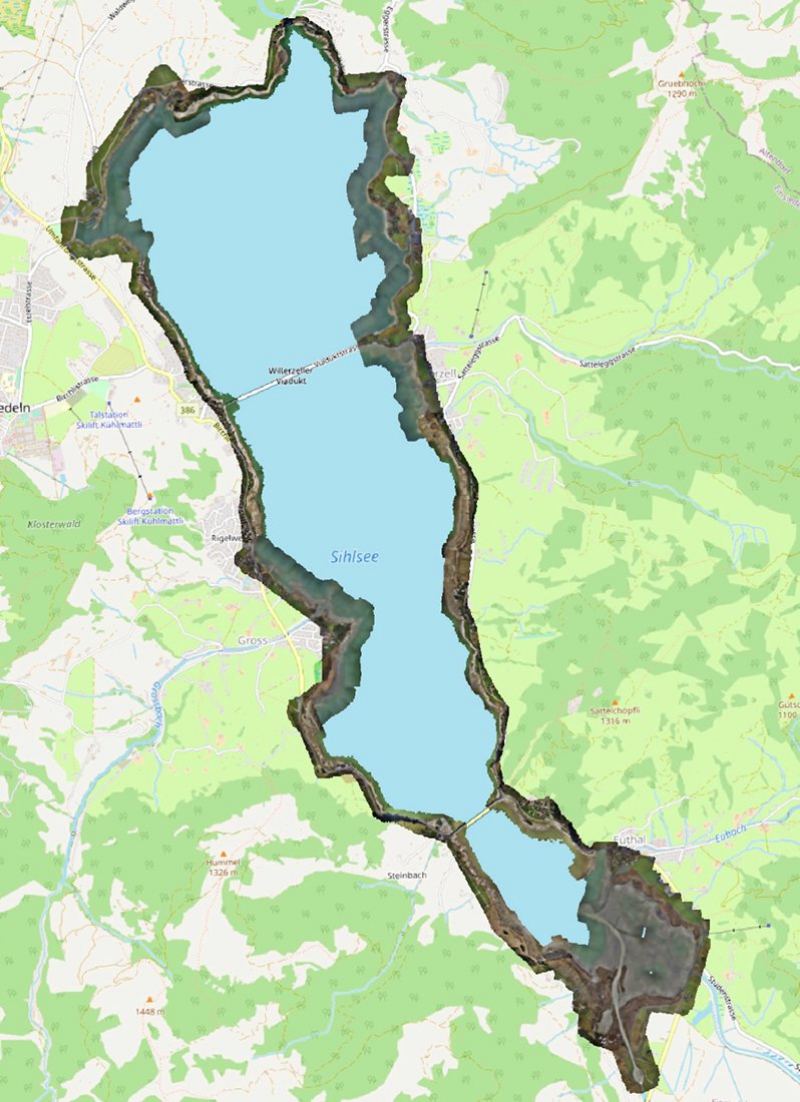
Sihlsee reservoir
“That’s problematic because as soon as it’s below the agreed level, SBB pays a fee every day. So there are two options: pump water up from Lake Zurich again—which costs a lot of money—or pay a fine,” Hoffmann said.
Because WingtraOne can take off from small patches of receded shoreline and cover the entire lake, at 4 cm (2 in) accuracy, fast, it can offer the data needed to back SBB’s request for regulation changes around the water levels. They’re now in discussions with the government about the agreed levels in light of climate changes.