
Verizon Skyward has announced a new service for users of its Aviation Management Platform, Live Flights, that tracks all of a company’s drones in near real time, from anywhere.
For managers in the office, this empowers greater oversight and transparency across the organization. For pilots in the field, it increases situational awareness and supports coordination during complex aviation operations.
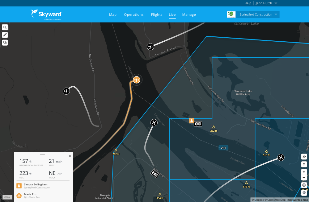
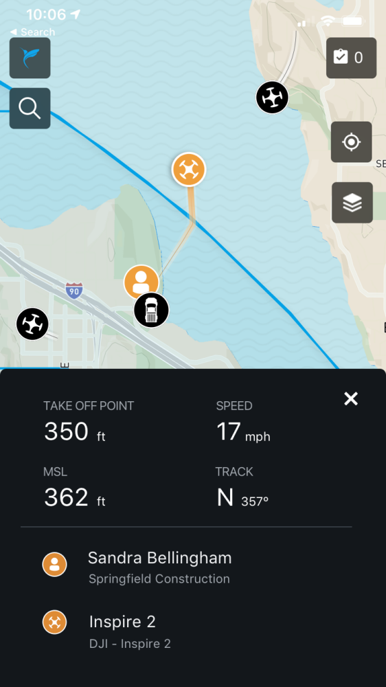
When subscribers fly with Skyward’s InFlight mobile GCS, aircraft information is sent into Skyward’s new Live Flights map. The map offers at-a-glance information including the drone’s location and flight path over the last 60 seconds. When you click on a drone, the map displays detailed information about the flight including aircraft ID, location, altitude, and velocity, as well as the location of the GCS and key pilot information. This information is visible on Skyward’s web and mobile apps to everyone within the organization.
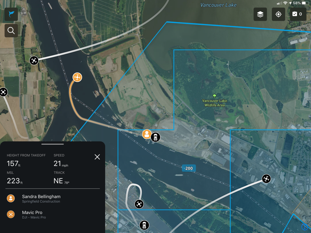
Customers with an Enterprise Skyward subscription can also use InFlight to self-report their location, flagging the position of items such as vehicles, observers, drones not compatible with InFlight, or landmarks. And administrators of enterprise accounts can see live flight information for all the organizations they manage.
A basis for Remote ID
Live Flights serves as a foundation for Skyward’s implementation of Remote ID. With the ability to transmit live position and identification data, Skyward aims to become a Remote ID UAS Service Supplier (USS). Today, Skyward lets program managers know who’s flying and where, improving visibility and compliance for enterprise drone programs. Tomorrow, we look toward a system of Universal Traffic Management in the National Airspace System.
Source: Press Release