
The TORUS project (Targeted Observation by Radars and UAS of Supercells) will be conducted by more than 50 scientists and students deploying a broad suite of cutting-edge instrumentation into the US Great Plains during the 2019 and 2020 storm seasons.
Led by the University of Nebraska-Lincoln, TORUS also involves the University of Colorado Boulder, Texas Tech University, the NOAA National Severe Storms Laboratory, and the Cooperative Institute for Mesoscale Meteorological Studies. TORUS instrumentation includes 4 unmanned aircraft systems (drones), 3 mobile radars, 8 mobile mesonets (trucks mounted with meteorological instrumentation), a mobile LIDAR (similar to a radar but using an eye-safe laser), 3 mobile sounding systems (balloon-borne sensor packages), and the NOAA P3 manned aircraft.
TORUS aims to use the data collected to improve the conceptual model of supercell thunderstorms (the parent storms of the most destructive tornadoes) by exposing how small-scale structures within these storms might lead to tornado formation. These structures are hypothesized to be nearly invisible to all but the most precise research-grade instruments. But by revealing the hidden composition of severe storms and associating it to known characteristics of the regularly-observed larger scale environment, the TORUS project could improve supercell and tornado forecasts.
TORUS Operations Domain
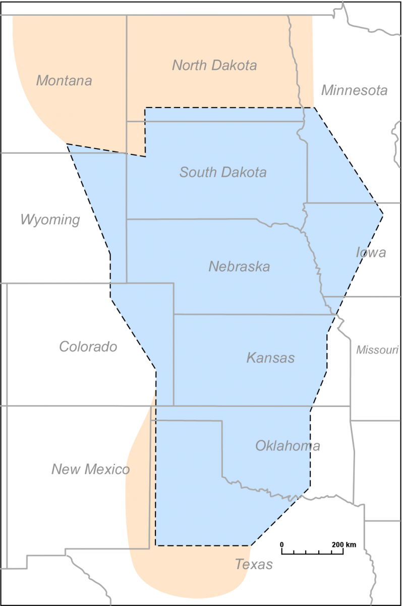
TORUS operations will be conducted in the Great Plains. The blue shading indicates areas where UAS during TORUS can fly up to a height of 2500′ above ground. TORUS operations may extend into the pink areas but flight ceilings are only 400′.
Source: Press Release