
The Aeromapper Talon Amphibious is the only truly affordable fixed wing UAV system that can be used for inspection and mapping in marine environments. The UAV system delivers high resolution georeferenced imagery as well as video feed from up to 30 kms from the operators. After completing its mission the UAV later returns and safely lands on the water, adequately serving maritime Beyond Visual Line of Sight (BVLOS) operations.
But how to ensure proper waterproofing for repeated landings on the water?
By design, the UAV can stay indefinitely afloat on the water, and even sustain full immersion without any damage or water intrusion, even in salt water.
To reach this level of dependability the engineers at Aeromao spent more than a year of lab work and field testing, experimenting with different materials, solutions & compounds, techniques and components to ensure a very high level of reliability. The base model is the well-known Aeromapper Talon, which has been the flagship for the company since 2014. The UAV is designed to fully survive and float even if fully filled with water, because internal components have been carefully waterproofed individually.
Some of the industries that can benefit from this technology are:
– Coastal & river mapping/surveying
– Fisheries
– Inspection of infrastructure or wildlife
– Ecology & conservation
– Surveillance
– Marine management
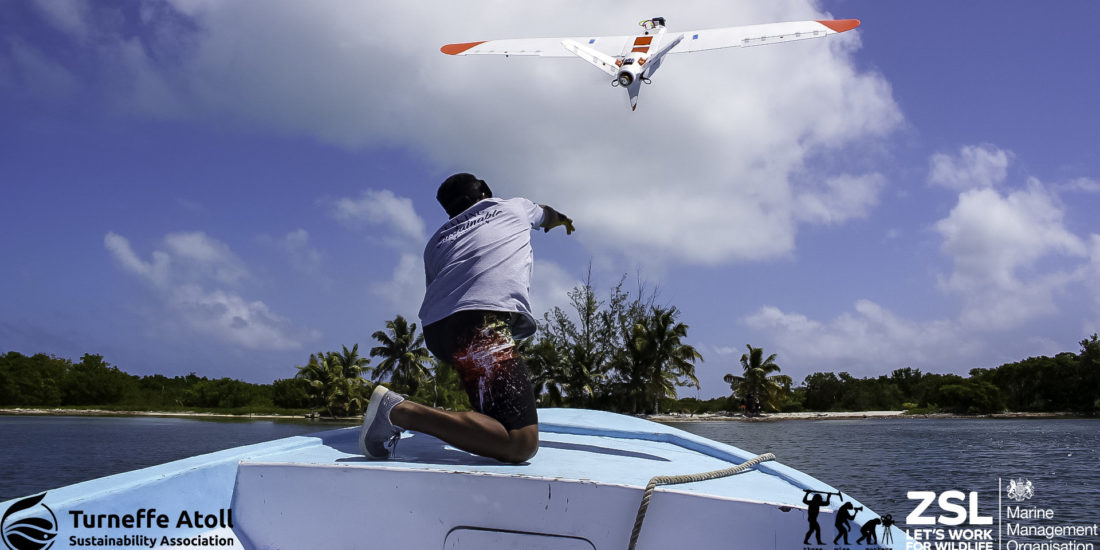
Flying on remote atolls
As of this writing, a couple of Amphibious Talon units have been successfully operating during a 4 week expedition by a worldwide renowned British conservation institution. The location is on an undisclosed remote atoll in Belize, as part of a series of very important efforts for conservation & ecology and enforcement and control of illegal fishing activities over protected areas.
The type of terrain offers little or no land to operate from, therefore only truly amphibious drones are usable. The drones have been successfully launched from both beaches or small boats and then landed autonomously landed on the water after each flight is completed.
The expedition team required a drone capable of be launched from a boat, record high-resolution video and stills, send live video feed to the Ground Station at very long ranges, be able to fly in 40km/h winds, return and land on water, and repeat several times daily and for several weeks. The Aeromapper Talon demonstrated to be the only suitable solution for the challenge. More information on the expedition to come soon.
Source: Press Release