
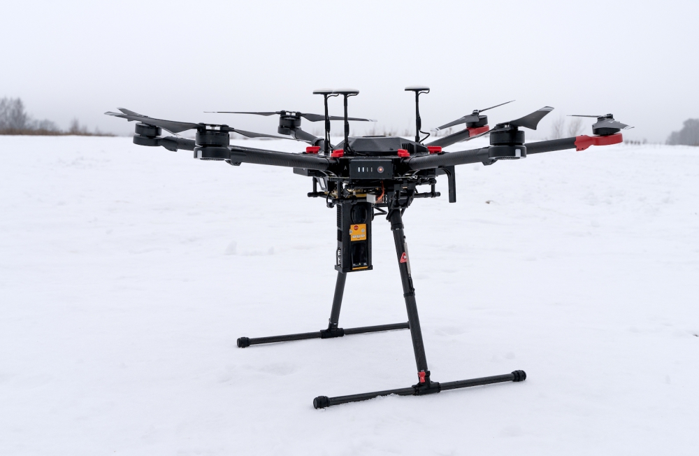
The second-generation Laser Methane Copter by SPH Engineering and PERGAM transfers high-precision data on the go. This solution answers the need for a safer ready-to-use drone-based detecting system for every company that produces, transfers or uses methane.
Natural gas pipeline surveys, tank inspections, landfill emission monitoring, gas well testing, plant safety audits — there are many applications for Laser Methane Copter. LMC G2 is a second-generation product, and is the latest creation of PERGAM, a manufacturer, distributor and service provider of world-leading gas leak detection systems and SPH Engineering, a UAV system integrator and software developer.
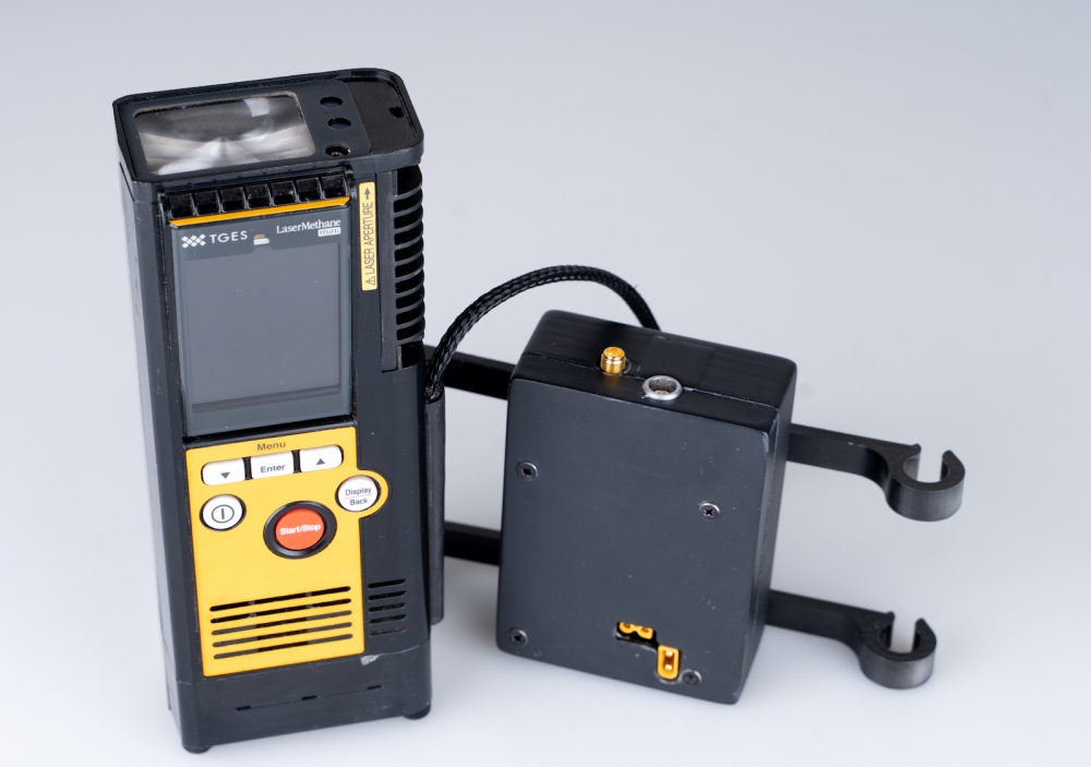
The high-sensitivity (1 to 50’000 parts per million per square metre) laser methane gas detector can pick up even the tiniest leaks from the height of 30 metres. The device is only sensitive to methane, so it is not possible for false readings to be made as a result of the presence of other gases. By beaming a laser light at a specific spectral range – 1.65 micrometres – the sensor captures its reflection, and where gas is present along the path of the laser path, the light is partially absorbed. The concentration of methane is calculated and displayed instantly.
The flying platform is based on DJI M600 and M600 Pro drones, which offer extended flight time (up to 25 minutes) and a 5-kilometre range for data transmission. It is equipped with an HD camera for maximum accuracy of image composition and capture. LMC G2 is really easy to operate and transport, allowing companies to cover vast areas.
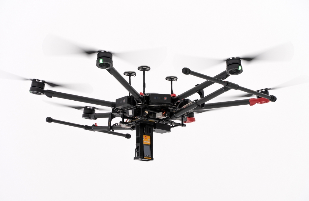
The LMC G2 onboard UgCS data logger, designed by SPH Engineering, saves the gas detector’s data in .txt format and transfers it instantly to the remote control system of the drone pilot or to UgCS desktop software. This allows operators to detect leaks in real time, without having to wait for the drone to finish its mission and land. This means faster response times and the ability to verify the precise location of the leak by returning to the detected point. UgCS software allows for the drone to be flown at a constant height — even over rough and mountainous areas, as its 3D maps and terrain-following mode can cope with any kind of landscape.
Source: Press Release