
Launched by hand from the shore or a boat, the fully-waterproof Aeromao Talon Amphibious is able to remain airborne for up to two hours on one charge of its battery pack, flying either autonomously or by remote control. It has a control range of over 30 km (19 miles), and will automatically return to its launch point if it loses radio contact.
As it flies, it uses a downward-facing camera to capture 20-megapixel stills or 4K/30fps video of the sea/lake/coastline below. Real-time video is transmitted to the user over a distance of 15 to 20 km (9 to 12 miles), or up to 40 km (25 miles) if an optional parabolic antenna is used. Buyers may also opt for a forward-facing camera that can be remotely panned, and that can lock on items of interest.
Once the drone’s aerial observation task is complete, it can autonomously perform a belly landing on the water – according to the company, it is the only such product to be able to do so. Parachute landings on dry land are also possible.
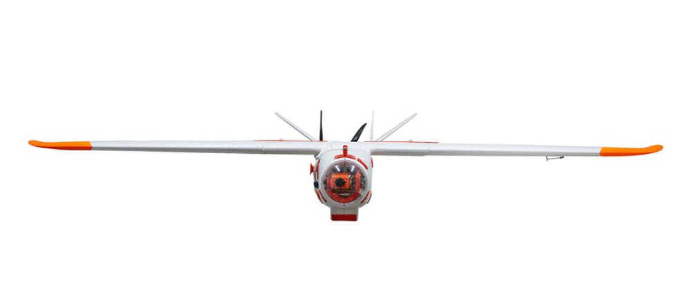
The drone itself has a 2-meter (6.6-ft) wingspan, weighs 3.6 kg (7.9 lb), has a maximum speed of over 85 km/h (53 mph) and is made from carbon fiber-reinforced EPO (expanded polyolefin) foam.
The UAV was successfully flown in the British Indian Ocean Territories (BIOT) as part of a scientific expedition led by the Zoological Society of London. This is the first time that a fixed-wing amphibious UAV has been used in the UK Overseas Territories and the applications of a water landing unit in marine ecological surveys, fisheries management and maritime surveillance are vast.
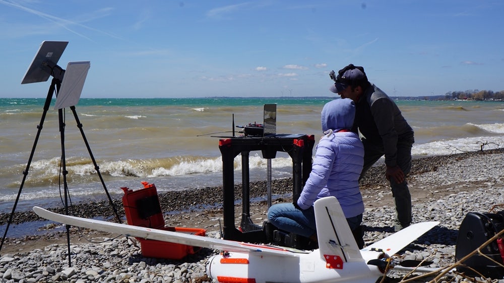
The amphibious UAV was piloted and trialled by an MSc student from Imperial College London, who described the unit as “An incredible tool for gathering vast amounts of ecological and habitat data, safe in the knowledge that we can easily land anywhere near the main vessel, on the ocean. In the tropics, rain clouds can often hit out of nowhere, and with this amphibious UAV, we no longer have to worry about rain water leaking in, either”.
Over 25,000 images were collected during the ecological surveys and the scientists were able to analyse the images to calculate the abundances of sharks and birds. Their camera of choice was the Garmin VIRB which allowed for geotagging of each image. The UAV is already gathering a lot of interest in the research world after being showcased at a marine symposium in London, with scientists and managers from around the world, looking to implement it into their coastal project operations.
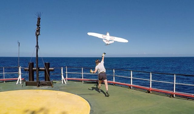
The UAV is quickly assembled and deployed by hand (easily done by anyone), from the shore, from a small boat or from large steel vessels, without disruption to the GPS system; an issue which can affect multicoptrers and VTOL drones. What makes this system unique to life on the water, is the fully waterproofed fuselage and internal components, using marine grade parts which will avoid corrosion from salt water. The development has been a careful, iterative process, taking on board client customisations quickly and efficiently. The UAV can also be equipped with a live camera system (excellent for monitoring and surveillance) as well as a 20Mp camera which will take crystal clear stills or film.
The UAV is simple to retrieve from the water using a small boat or you can land it near to, or on a beach. With a cruise speed of 60kph, communications range of +30Km and flight endurance of nearly 2 hours, you will be able to cover a huge area, saving money and time. Based on trials at sea, we learnt that finding a UAV that goes out of sight, is important, so a GPS beacon will let you know where it is, for easy boat-based retrieval.
Source: Press Release