
The expedition, led by Jim Salazar and Ken McBride from Arctic Hotpoint Solutions and Fallen American MIA Repatriation Foundation (FAMIARF), just returned from Greenland’s Ice Cap having reached all set targets with success. The targets were to locate P-38 “Echo” dogfighter from Lost Squadron and to test new Drone/GPR research technology to locate airplanes buried under 300 feet or more of ice.
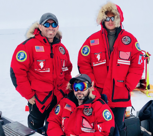
The eight-day expedition on the Ice Cap was carried out by a team (Fig.1) joining specialists in their respective fields:
• Jim Salazar and Ken McBride from Arctic Hot Point Solutions (AHPS) and the Fallen American MIA Repatriation Foundation (FAMIARF), USA
• Mario Carnevale and Myles Danforth from Hager GeoScience Inc. (http:// www.hagergeoscience.com), USA
• Janis Kuze and Alexey Dobrovolskiy from SPH Engineering (developer of UgCS http://ugcs.com), Latvia.
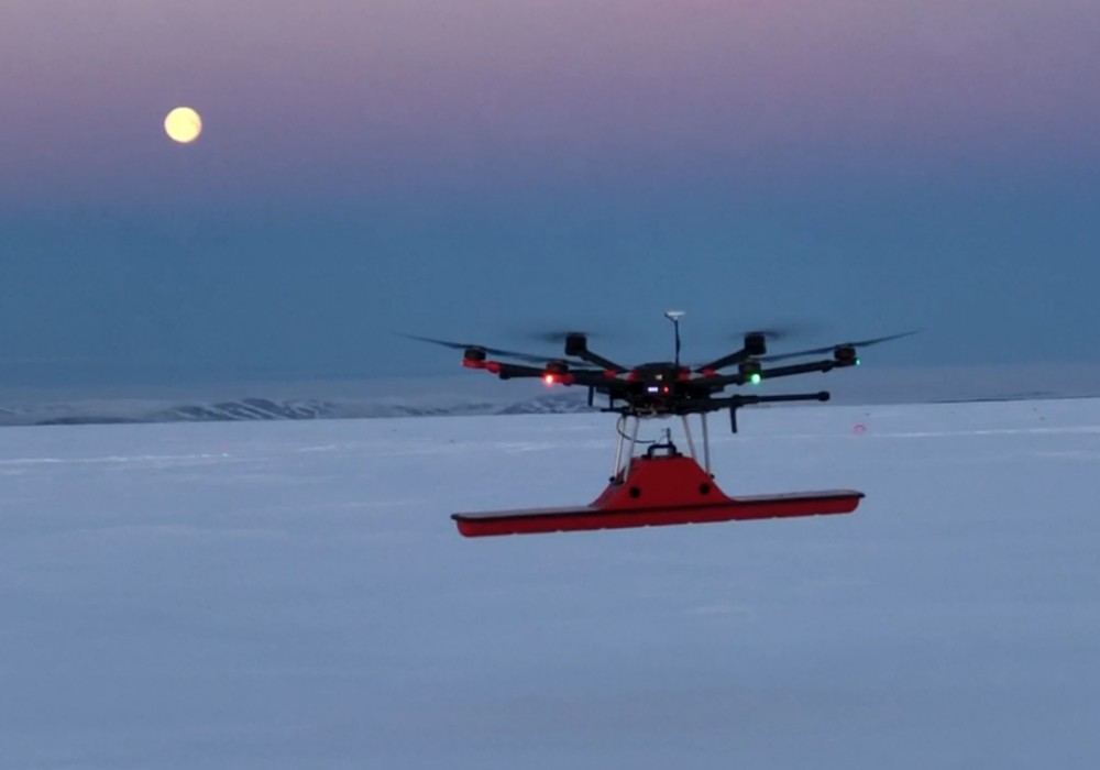
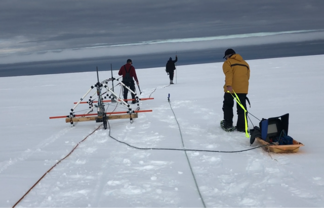
The team worked in two groups – the UAV group started the research with the new technology – a Ground Penetrating Radar (GPR) and drone integrated system to locate the P-38. The acquired data showed anomalies at a depth of around 300 feet.
UAV radar’s contact was confirmed by the ground surveying group. The distance between determined locations of both groups was 10ft. Taking into account surveying data of both groups, a location for the drilling was calculated.
The moment of success for the expedition came in the form of a red fluid extracted from a depth of 340 feet. Preliminarily, the acquired substance is identified as 5606 Hydraulic fluid used in US aviation. The samples of the fluid have been delivered for detailed chemical analysis.
Experience gathered during the expedition confirmed the applicability of modern technologies to search and locate deep targets buried in glacial ice. Practical involvement of the equipment highlighted the inability of some equipment to function as expected in Greenland’s harsh environment, requiring some adjustments for further expeditions. The overall results are very promising and proved that the performance of aerial surveying is ten times more effective compared to ground surveying and less risky for ground operators.
Future plans of Arctic Hot Point Solutions/FAMIARF include organising the excavation of the found P-38 “Echo” and further research to locate other aircraft of the Lost Squadron in Greenland.
“We are confident that this innovative technology will assist our upcoming projects with the search of the USCG J2F Duck in the 2019 expedition,” said Jim Salazar of Arctic Hot Point Solutions, director and founder of the Fallen American Missing In Action Repatriation Foundation.
Source: Press Release
Excellent use of a drone, doing the dirty and dangerous for the expedition. Wow, under 300′ of ice, I would have assumed that the wreckage would be crushed like a beer can. Then again perhaps due to layering etc the whole weight is not on the airframe.
I have a family story about a member of our family going on an expedition to locate a plane that went down during WorldWar II. It went down in GreenLand or Nova Scotia. The family membe3r was a Dr. Albert Martin or Dr. Sam Martin. How could I find out about this? I want to include this in my family hitory. Thank you in advance for any help.
Janet,
You could try contacting the Fallen American MIA Repatriation Foundation :
https://www.facebook.com/FAMIARF/