
Headwall has introduced advanced sensor payloads consisting of hyperspectral sensors and LIDAR for deployment on Unmanned Aerial Vehicle (UAV) platforms. Through the fusion of spectral imaging data and 3D LIDAR output, Headwall continues to provide new capabilities for addressing critical remote sensing applications ranging from civil and military infrastructure inspection to crop science applications requiring discrete solutions for crop monitoring.
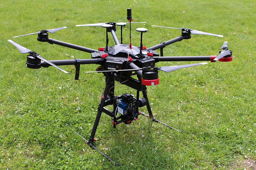
The Headwall payload consists of a Hyperspec spectral imager, a LIDAR unit, a UAV, a high-performance GPS/IMU, and the associated software for data acquisition and workflow processing for exploitation. The combination of hyperspectral and LiDAR is especially powerful because the entire data set can be acquired on inexpensive UAV platforms with both sensor instruments operating simultaneously. Headwall’s software will allow for the control of both instruments, utilize the Digital Elevation Map for image creation, and allow for the merging of spectral datasets with the 3D point cloud.
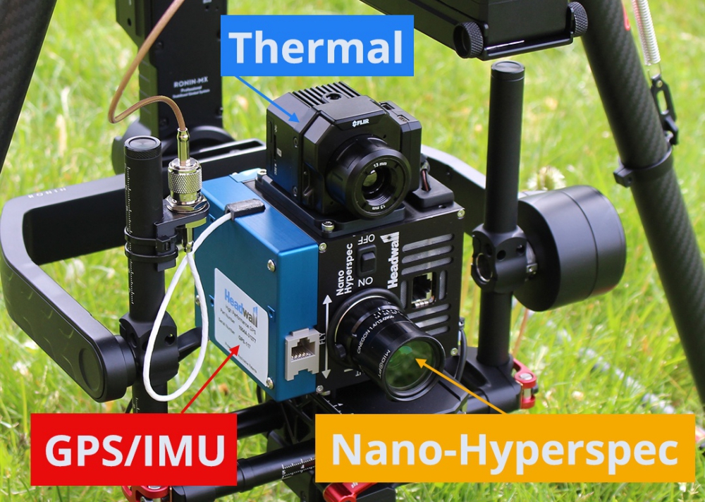
Headwall’s Nano-Hyperspec, a VNIR spectral imaging sensor covering the 400-1000nm range across 270 narrow spectral bands. It’s about the size and weight of a Rubik’s Cube
As instruments get smaller and lighter and UAVs get more robust and powerful, Headwall’s integrated airborne packages are designed for low-altitude, high precision flight for applications where high spectral and spatial resolution is required. Headwall’s focus is on integrating these sensor modalities and providing the necessary image workflow analysis for data exploitation.
“We continue to lead the industry with these integrated solutions that are based on solving costly problems for our customers,” said Headwall CEO David Bannon. “Hyperspectral sensing is in high demand right now, and Headwall continues to lead the industry with enabling data acquisition platforms as well as data exploitation and interpretation software,” said Bannon.
Recognizing the growing market and need for LIDAR within remote sensing, David Bannon stated that
“the fusion of LIDAR and hyperspectral imaging represents a key enabling technology for many remote sensing applications from civil infrastructure inspection to crop monitoring. With many years of experience, we are delighted to closely work with all of the leading LIDAR manufacturers in the industry to bring these capabilities to market.”
Headwall’s successful implementation of hyperspectral and LiDAR also involves a high-performance GPS/IMU, which collects both geographical data (the GPS) and roll/pitch/yaw information from the UAV (the IMU). This data as well as LiDAR and hyperspectral information is stored aboard Headwall’s small Nano-Hyperspec, which includes a 500GB solid-state drive within its enclosure. Combined, the entire data set will represent a geo-rectified point cloud consisting of fused spectral and LIDAR output, which will be an industry first.
Source: Press Release