
Kittyhawk, a supplier of commercial drone operations software, has announced a comprehensive set of new features for its best-in-class platform. Kittyhawk is introducing secure multi-party, multi-channel video and audio streaming, native UAS Facility Maps, new notification and telemetry sharing options with a focus on enhanced security and visibility.
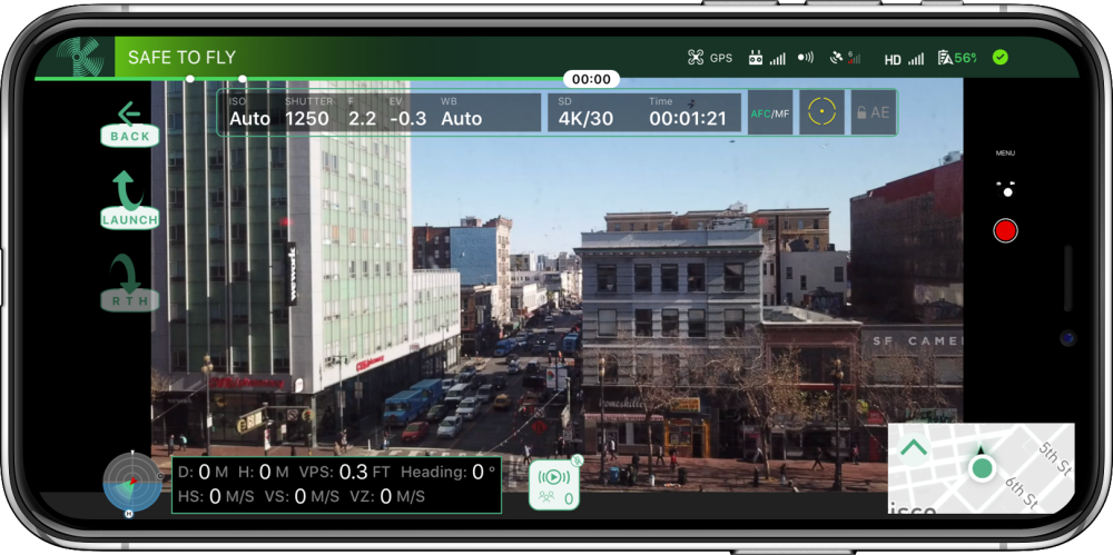
Multi-party, multi-channel audio and video supports unlimited concurrent streams with up to 50 simultaneous participants per stream. Multiple operators can collaborate in real time from any location in the world utilizing a smartphone or tablet. Pilots can select stream quality preferences (480p, 720p, 1080p) or just set to “Auto” to optimize for the device and local data speed. In addition, broadcast display options can stream either a “heads-up display” to view flight information or simply stream the camera view with no additional layers. Enterprise customers can see who on their team is broadcasting a live stream, switch between streams like channels on television, and even see which of their other team members are watching the stream in case they need to ask them questions.
Law enforcement can now have access to multiple vantage points of a situation and inspectors can have uninterrupted views on critical pieces of equipment. The ability to change a vantage point in milliseconds from thousands of miles away, all while being in communication with the pilots makes for a potent combination.
New UAS Facility Maps show the maximum altitudes around airports where the FAA may authorize Part 107 UAS operations without additional safety analysis. The maps should be used to inform requests for part 107 airspace authorizations and waivers in controlled airspace. There are nearly 500 airports with published FAA Facility Maps that will come online at the completion of the Low Altitude Authorization and Notification Capability (LAANC) pilot program. These maps remove ambiguity on whether or not a flight could be approved, whether with LAANC or manual authorizations. Each of the facility squares are color coded according to the maximum altitude allowed, or flight ceiling. Now, users have a beautiful, intuitive flight planning map available to them for all of the current and future LAANC compatible sites.
“As the FAA is completing the LAANC pilot program, we thought it was important for Kittyhawk to continue leading the charge for private industry to support their efforts with our products. These new maps add clarity and transparency from what was relatively opaque data,” said Joshua Ziering, Founder & Chief Pilot.
Kittyhawk’s new telemetry-sharing options add greater control with a focus on security and visibility. Enterprise teams now have three new options for how telemetry is viewed within an organization, within the Kittyhawk platform, and across the national airspace via industry partners.
First, the Private (Team Only) option allows only the members within your team to view live telemetry, both from the app and the web. Second, the Kittyhawk UTM option shares anonymized information and telemetry of live flights to improve airspace awareness and deconfliction. Third, Kittyhawk Extended shares flight information to third parties like airports, schools or AirMap, for example, as well as within the Kittyhawk UTM.
In addition to enhanced telemetry controls, Flight Deck now includes DJI’s Local Data Mode. DJI recently implemented this feature in its flight controller and SDKs to help address security concerns about sensitive data unintentionally going to DJI. With this enabled, there is no communication at all with DJI. Even with Local Data Mode enabled, Kittyhawk connections, telemetry, and data flow are not affected.
“The common theme across each of these announcements is they empower enterprise teams to thrive and scale. Beautiful products with real-time data streams in a secure environment enable companies’ drone operations to grow and their utilization of Kittyhawk to evolve,” said Jon Hegranes, Founder & CEO.
Source: Press Release