
The US National Forest Service commissioned the study of the Hiawatha National Forest to determine two things.
“One is the feasibility of using drones for doing coastal wetland mapping in the Hiawatha Forest and then more specifically for invasive species,” Michigan Tech University assistant professor of Remote Sensing and Geospatial Information Science Curtis Edson said.
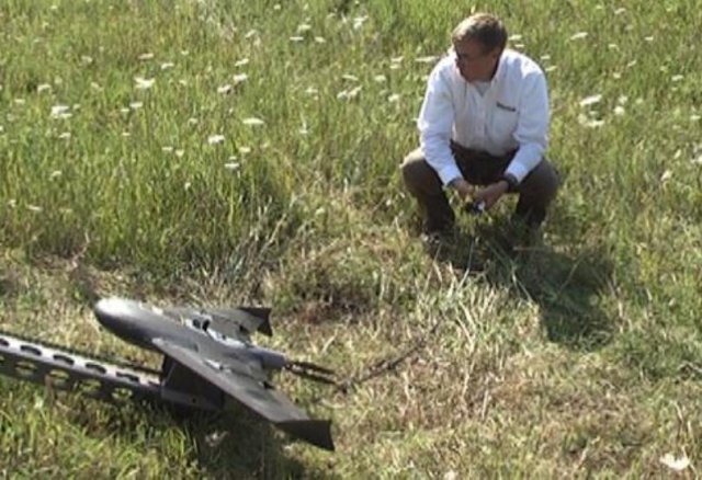
The battery powered drone takes off from a bungee cord launcher, and can stay in the air for about a half hour per charge.
Each image taken from the air is tagged with a GPS coordinate, and stitched together, with a secondary GPS unit on site to improve the accuracy of each shot.
This gives scientists a resolution of around one centimeter per pixel, or enough to identify a flower from an image taken at nearly 300 feet in the air at 50 miles per hour.
“This is the Ogontz Bay, I’m doing three different locations for this pilot study,” Edson said. “This one is approximately two miles wide by a mile deep and I have to do several flights in order to capture that.”
The high resolution images allow researchers to look for non-native species that could be invasive.
“The National Forest Service can then go and remediate that by ridding the area of those invasive species,” Edson said.
According to scientists, not all non-native species are invasive.
Rose bushes for example are not a native species, but they do not invade the area, displacing the local flora and fauna.
“Bottom line, what we’re looking at over all the project is to inform decision makers for the forest service whether they want to go this route or maybe some happy medium in between,” Edson said.
Edson said this kind of drone use is for professionals licensed by the FAA, and anyone thinking about wanting to use a drone for larger projects should check with the FAA and be licensed.
Source: TV6