
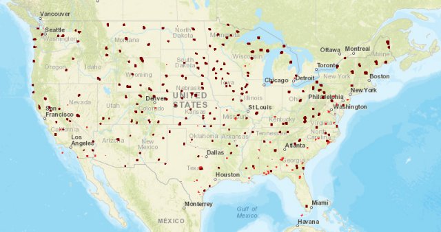
The Federal Aviation Administration (FAA) has published more than 200 facility maps to streamline the commercial drone authorization process. The maps depict areas and altitudes near airports where UAS may operate safely. But drone operators still need FAA authorization to fly in those areas.
This marks a key first step as the FAA and industry work together to automate the airspace authorization process. The maps will help drone operators improve the quality of their Part 107 airspace authorization requests and help the FAA process the requests more quickly. The maps are informational and do not give people permission to fly drones. Remote pilots must still submit an online airspace authorization application.
Operators may download the map data in several formats, view the site on mobile devices and customize their views. The map viewer displays numbers in grid cells which represent the distances Above Ground Level (AGL) in one square mile up to 400 feet where drones may fly. Zeros indicate critical locations around airports and other aircraft operating areas, like hospital helipads, where no drone flights can be preauthorized. Requests to operate in these areas will require further coordination and FAA safety analysis, which can result in additional safety mitigations to be complied with by the drone operator. Remote pilots can refer to the maps to tailor their requests to align with locations and altitudes when they complete airspace authorization applications. This will help simplify the process and increase the likelihood that the FAA will approve their requests.
FAA air traffic personnel will use the maps to process Part 107 airspace authorization requests. Altitudes that exceed those depicted on the maps require additional safety analysis and coordination to determine if an application can be approved.
Additional maps will be published every 56 days through the end of the year. The updates will coincide with the agency’s existing 56-day aeronautical chart production schedule. If a map is not yet available, it can be expected in future releases.
UAS Facility Maps show the maximum altitudes around airports where the FAA may authorize part 107 UAS operations without additional safety analysis. The maps should be used to inform requests for part 107 airspace authorizations and waivers in controlled airspace.
NOTE: These maps DO NOT authorize operations in these areas at the depicted altitudes – they are for informational purposes ONLY. Requests to operate in controlled airspace (Class B, C, D, or surface area E) must still be submitted through the FAA’s Online Waiver Portal.
Individuals who request a part 107 airspace waiver and authorization are encouraged to consult the maps prior to submitting a request to determine locations and altitudes that can be approved quickly.
The maps will be published in phases, starting with Class E airport maps (published April 27, 2017).
Source: FAA