
 A Taranaki drone company has made history by flying an unmanned aircraft “beyond line of sight” to inspect power transmission lines in the Rimutaka Ranges. Drone Technologies Ltd used an unmanned aerial vehicle controlled remotely by a team on the ground, to survey a 30 kilometre section of transmission lines and towers in the Rimutaka ranges for Transpower. It was New Zealand’s first “beyond line of sight” flight and could see drones being used more by industry and agriculture, and for delivering goods in difficult situations, Drone Technologies ceo Ben Plummer said.
“This opens up the door for other uses, such as delivering parcels and medical supplies to remote locations or communities in crisis,” he said.
Sophisticated technology enabled the UAV aircraft to fly low over difficult terrain and in risky conditions where a human pilot would not be able to go.
“It is cost-comparable solution to manned aircraft and eliminates a risk because it doesn’t require someone to physically be there to navigate.”
The drone flight was carried out with the same procedures, safety checks and planning as a manned flight. It required a flight plan, getting permission to operate in that airspace at that time, and intensive training for the pilots.
“It’s classed as an aircraft. The ground crew effectively become the pilots,” Plummer said.
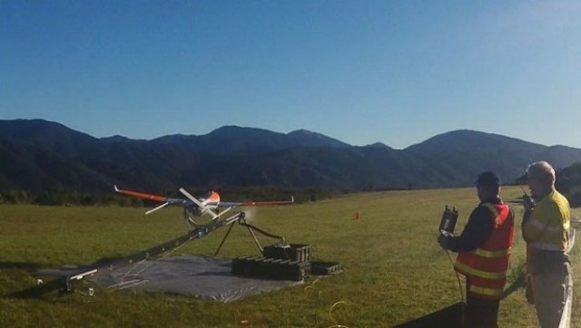
Flight crew members launch a drone aircraft during a trial flight inspecting Transpower’s transmission lines in the Rimutaka Ranges near Wellington.
During the 54 minute flight they flew a rotary craft along the line as well to collect a different data set. The rotary craft was able to hover close to the structures and get close-up footage of towers and lines. The event was comparable to the introduction of GPS technology, which was developed for military uses and was initially very expensive, but just a few years later was commonplace in smartphones, cars and other devices. Transpower would study the data collected on the flight and decide if it would begin using UAVs on a larger scale to monitor transmission lines and equipment. Transpower’s general manager of grid development, Stephen Jay, said the company had been working with the Civil Aviation Authority to trial drone flights near its transmission lines and towers since 2013.
“These trials have shown us that a combination of drone and helicopter flights can help us achieve considerable efficiencies in how we inspect and maintain the National Grid,” he said in a media statement.
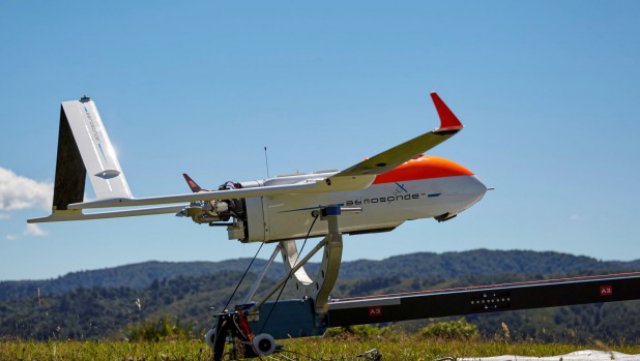
A Textron Systems Australia Aerosonde fixed wing drone is set for launch.
“It captures a multitude of information in a single pass instead of having to fly multiple passes,” Plummer said.
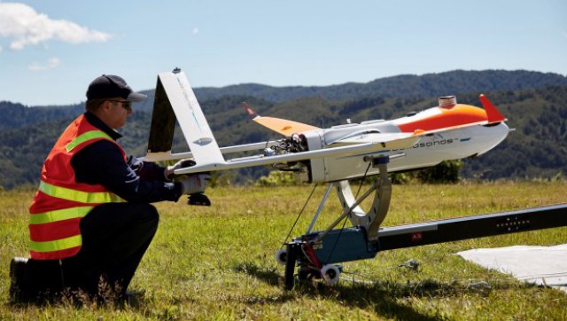
Using drones had less impact on land owners than helicopters and aircraft, he added, as they were less intrusive on people and animals. Top Photo: Flight crew member Maurice Gonella from Drone Technologies prepares the drone aircraft for launch during a trial flight inspecting Transpower’s transmission lines in the Rimutaka Ranges near Wellington on February 24.
Source: stuff