
 A federal effort to produce better maps more quickly and cheaply with drone technology got a test run recently at Coast Guard Beach, Cape Cod.
A small unmanned drone that looks like a model plane was flown across the beach and over Nauset Marsh to produce three-dimensional, high-resolution maps similar to images you might see with Google Earth software, U.S. Geological Survey research oceanographer Chris Sherwood said.
The National Park Service approved a permit for the use of the drone from Monday through March 20, Cape Cod National Seashore Superintendent George Price said in an announcement Friday. The USGS project is the first authorized use of drone technology for a research project in the Seashore, Price said.
The Seashore spans 44,000 acres of private and public land, crossing the six easternmost towns on Cape Cod, including Eastham.
The USGS also received written permission from the town of Eastham, Mass Audubon and a land trust to fly over and map their parcels within the Seashore, Sherwood said.
“We will not fly over any other privately owned properties,” he said.
The town of Eastham does not have formal permitting requirements for drones, Eastham Town Administrator Sheila Vanderhoef said.
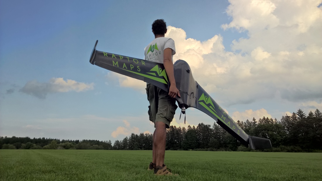
The test was with a relatively inexpensive drone, costing about $2,000, with a good camera, and using a careful flight pattern executed by the USGS staff and drone contractor Raptor Maps, Sherwood said.
“This is really a proof-of-concept map,” he said.
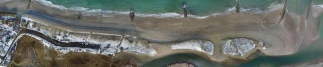
A drone-produced map could capture images of a beach just before and just after a winter storm to document coastal erosion and better tie changes in the landscapes to wind and wave activity, Sherwood said. The USGS has recently completed a test at Town Neck Beach in Sandwich, under a permit from the town, Sherwood said. Images at the Sandwich beach were taken on Jan. 22 and then on Jan. 25, the day after a nor’easter, and also on Feb. 11, and a “difference map” was produced that showed where sand was lost and gained, he said.
The Raptor isn’t the first drone to be used locally in the name of science.
National Oceanic and Atmospheric Administration seal researchers used a hexacopter, a type of drone, in January on Muskeget Island off Nantucket to help count gray seals. In July, Woods Hole Oceanographic Institution scientists used a hexacopter to take photographs of humpback whales in the Stellwagen Bank National Marine Sanctuary, north of Cape Cod. The team also flew the hexacopter, with a sterilized surface, through whale spouts to collect breath samples.
The use of drones has been under strict control in national parks since 2014 because of incidents of drones being used in ways that harass wildlife, bother park visitors and interfere with firefighting aircraft, according to Price. Drones are permitted when the proposed use supports the mission of the Seashore and the National Park Service overall, he said.
“I do know that our natural research folks in D.C. are pleased with this piece of equipment, they told me, because it is quieter than older equipment used elsewhere,” Price said.
Raptor Maps operates within Federal Aviation Administration guidelines, according to company material online.
Among the reasons for the USGS test is to work through the permitting process and deal with weather and other logistical challenges, Sherwood said.
Source: Cape Cod Times