
Scientists have deployed drones over western Idaho to map a little-known landscape as part of an effort to reduce wildfire risks and protect sage grouse and other wildlife across the West.
They say they have to learn more about what grows in the region so that when charred areas are restored, land managers don’t plant a type of sagebrush that sage grouse won’t eat.
The football-sized bird found in 11 states is being considered for federal protections under the Endangered Species Act.
“The lack of maps is a huge, critical problem for conserving sagebrush and any species — like sage grouse — that depend on it,” Matt Germino, a U.S. Geological Survey ecologist, said.
“We have probably replanted the wrong type of sagebrush to some habitats,” he said.
A key part of the Interior Department’s new wildfire strategy involves replacing native plants after giant blazes, which have been an increasing problem in rangeland in many Western states over the last decade. Such efforts would reduce the likelihood of invasive plants, which often burn more easily, from overrunning scorched areas.
But without maps, land managers can’t be sure which sagebrush subspecies to plant.
Scientists want to use drones to identify and map the range of three subspecies of big sagebrush. The most abundant is called Wyoming big sagebrush. Basin big sagebrush is the most drought-tolerant. Mountain big sagebrush, meanwhile, is typically found at higher elevations.
The first problem with creating such a map, scientists say, is the enormous size of the landscape. Attempts to use satellites have failed because they can’t supply the necessary detail. Sending scientists out to map on foot isn’t practical because of the giant landscapes involved.
The second problem is that the three sagebrush subspecies are so similar that even expert botanists examining plants close up have trouble telling them apart.
Wildlife, however, can tell the difference, Jennifer Forbey, a researcher with Boise State University, said. For sage grouse, she noted, their entire winter diet is sagebrush.
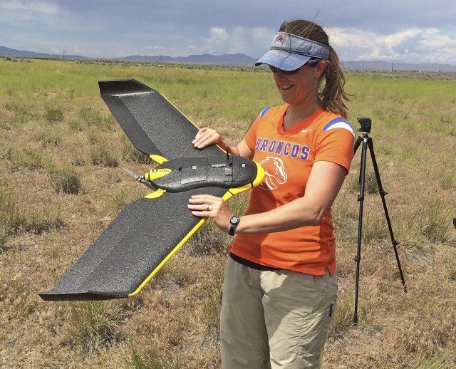
Forbey last week flew a drone over managed plots of sagebrush west of Boise containing the three plant species.
The drone flew with three different camera lenses to provide different images, including infrared, that Forbey said could be layered to possibly determine the types of sagebrush. The technique, she said, has been successfully used in agriculture.
“In about two hours they fly a square kilometer of area using multiple sensors,” Forbey said. “They’re very rapid.”
She said it will take months of analysis to determine if the drone map-making plan will work.
If successful, the map information could be used by Francis Kilkenney, a research biologist with the U.S. Forest Service Rocky Mountain Research Station who is also the Great Basin Native Plant Project leader. The project is run by the Forest Service and U.S. Bureau of Land Management.
He said drones could map plant communities before a fire, determine the amount of damage after a fire, and then track the success of reseeding efforts in following years.
“We can target plant communities that are critical habitat for wildlife,” Kilkenney said. “I’m excited to see what results come out of it.”
Photo: Boise State University professor Jennifer Forbey examines a drone prior to launch June 10 in an area west of Boise – Associated Press
Source: Argus Observer