
 Pix4D has just released Version 1.1 of Pix4Dmapper with the precision agriculture market in mind.This new version comes with an integrated Index Calculator that allows users to create meaningful maps from any multi- spectral sensor and customize their NDVIs and any vegetation index map directly in the software.
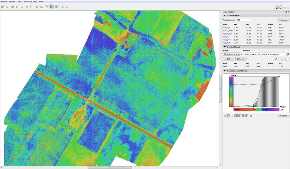
How to get from UAV imagery to NDVIs in one workflow and some clicks only? It all starts with using either multi-spectral sensors or more than one camera, for example processing NIR and RGB imagery together in one project. Once the images are processed, the newly integrated Index Calculator will let users do the rest in a few simple clicks. After setting or editing the map resolution, users can choose from pre-defined formulas to generate single-band and index maps or create and save their own formulas. Results can then be customized by editing colour classes and gradients to create index maps with the most appropriate colour scheme.
This new feature will open up countless new applications for UAV imagery, not only in precision agriculture but any field requiring an easy-to-use and fully integrated solution to generate meaningful maps out of multi- spectral sensors.
In addition to the Index Calculator, Pix4Dmapper’s Version 1.1 provides full support for all GoPro models and lenses, including the Fisheye lens, removing GoPro lens distortion automatically. Imagery can be acquired both from the ground or the air using any UAV, opening up a whole new world of modelling possibilities. Version 1.1 also includes more and improved rayCloud features for project re-optimization, filter creation based on image content, contour line creation and improved object annotation to mention just the most important.
Pix4D organizes User workshops (both for beginners and advanced users) again this year. The first workshops will take place in early July in Lausanne, Switzerland. In addition, Pix4D has introduced monthly webinars in March to offer shorter and more targeted training sessions. Detailed programmes and registration for both webinars and workshops are available on Pix4D’s website
Source: Press Release
For small mosaicos it work fine ..
try with 10kmx4km and you see what i am telling you.